 “George Washington was a surveyor, right?”
We have a lot of blogs about Survey. If you’re in on what that word entails, then cool. But if you are like my friends and family who read my blogs (shoutout to you guys 🙂 ), you may ask, “What is survey? When is it used? And how is it done?” As I said in the first segment of this series, I come from a history/English/arts background. If you said survey, I’d first think, “George Washington was a surveyor, right?” So, I can’t help but give you just a little bit of the basic history when it comes to survey.
I’ll give a quick shoutout to the first professional surveyors in the American Colonies, Charles Mason, and Jeremiah Dixon. These two worked for the proprietors of Pennsylvania in 1763, who developed, you got it, the iconic Mason-Dixon line. If you want the in-depth version of this era of survey, head over to this magazine article.
We are going to skip to the 1960s, when engineers began implementing laser scanning as we know it now. Scanning was limited by the fact that in the 1960s computers were not what they are today. Still, the vision was there. The idea of capturing reality with laser scanning was born… it would just take some time to develop. By the 1990s, the scans still had limitations. But, with each coming year, the equipment became lighter, easier to use, and more accurate. Helpful too was that computers and hand-held smart-devices advanced.
What is survey?
We’ve danced around it long enough. What do surveyors actually do today?
Survey is more than just measuring boundaries and staking out construction sites. Today, we use highly accurate, 3D hi-definition scanning techniques that map surfaces from the ground, in the air and while in motion. We use mobile LiDAR, terrestrial scanning, rail and tunnel measurement. Also, GPS, which uses satellites to determine your position on earth, and RTK, a type of GPS method (Real Time Kinematic). We use robotic total stations, which have taken the place of optical total stations, eliminating the need for a person to physically look through the scope to measure angles and distances. There’s also boundary and topographic mapping; hydrographic, wetlands and forensic surveying. From the air, we use drones (a.k.a. UAS) to fly around a project and take in data from above. This is ideal for large projects like a Solar Farms.
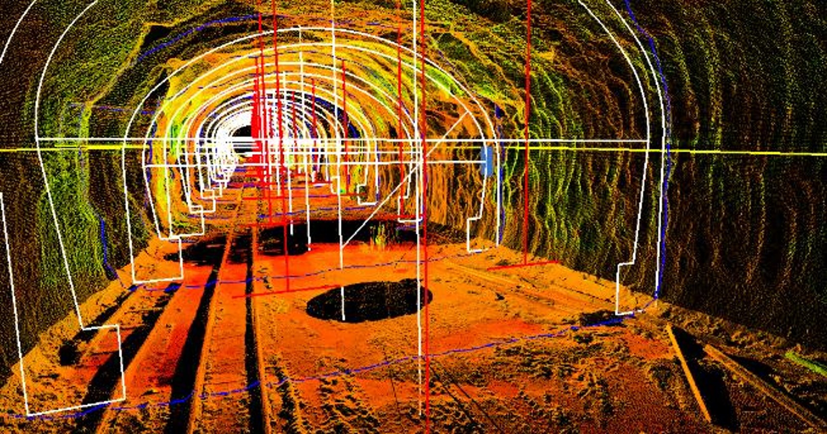
From the ground, we use mobile mapping, terrestrial scanning (so like manned by a person instead of being mounted on a car or train like mobile mapping or Amberg trolleys). Pavement projects, topographic surveys, tunnel mapping, track geometry, construction as-builts, and roadway and rail corridor clearance analyses are all examples of projects we can do with survey. Ever wonder how speed limits are determined? Want to take a guess? Survey.
And before I forget, if you want to learn a little more about how our Mobile LiDAR division originated, and about our own Clay Wygant, geospatial man-on-the-move, who began by setting out with his crew and a RIEGL VMX 450 mobile mapper atop his truck, zig-zagging and scanning his way across the country, check out this blog!
Why Do We Need It?
Ok people, so diving into Survey today, let’s also answer why modern survey needs to exist. That might help you better to understand what it is.
Imagine a really old bridge. We need to be able to see where the materials stand: are there cracks, are things degrading, did something about it change? Wouldn’t it be helpful to have a REALLY detailed account of what that bridge’s situation is year to year? Now imagine you have a building and want to do some alterations. Of course, you have specs, but what if something has changed since it was originally built? What about if you had a solar field and needed to check annually for changes? What if you want to know the exact slope of a road, or how wide a busy street is? There are so many more examples I could give (rail projects, tunnels, warehouses, traffic intersections… literally so many) but I think you get the picture.
Let’s Break It Down Further
So, if you understand the problems that survey solves, let’s also figure out how it solves them.
Let’s think about that bridge again. You could have a guy go out and look at it and give an account of what it looks like, and check for cracks and other issues, but how reliable is that? Even if we account for human error, we still have the problem that the human eye has limitations. It wouldn’t be a detailed account. Also, it would take a reeeeeeallly loooooong tiiiiime. And time is money, so yeah it would be expensive to try to have humans spending that much time gathering limited, inaccurate, and probably not-so-precise data. This would especially be inadequate for projects that require change detection from year to year. Think of all the time that would take!
Conventional Survey: The Process
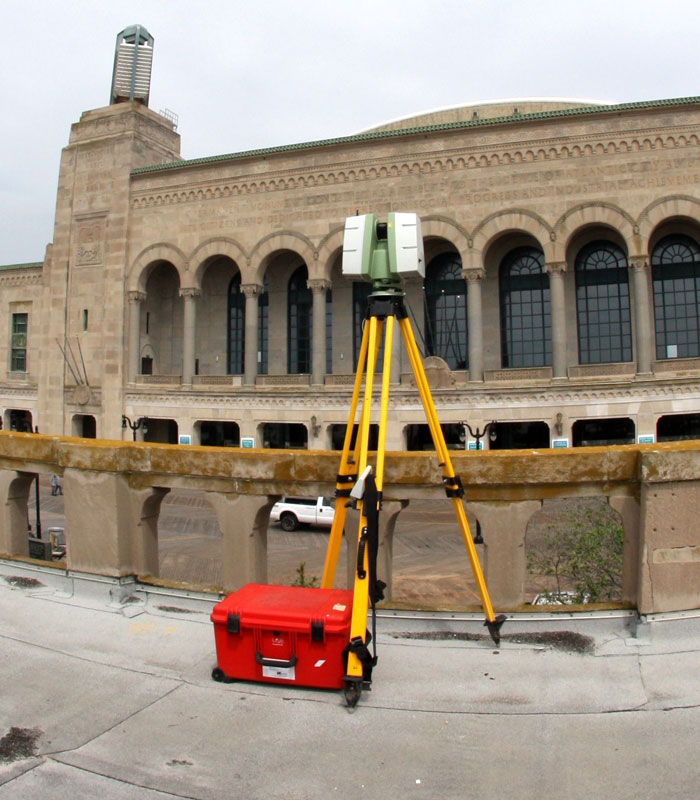
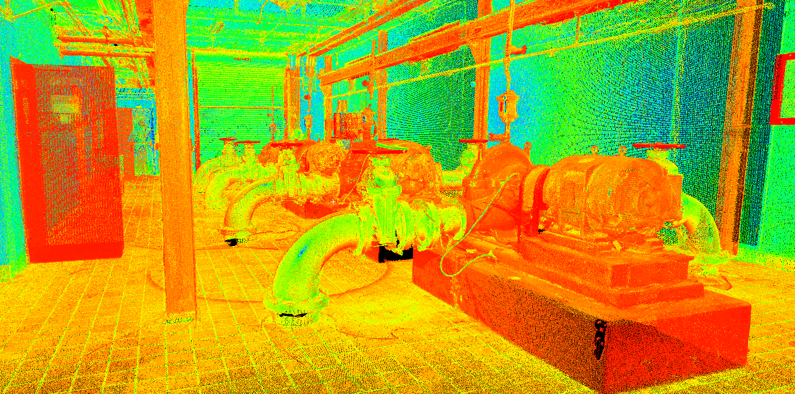
Although there are a lot of forms of survey, perhaps the most widely used and universally needed one is conventional, boots-on-the-ground survey (a.k.a. terrestrial survey). Terrestrial laser scanning aims to capture reality at a rate of up to two million points per second. How is it done? Laser scanning workflow begins with project planning. Surveyors ask many questions: Do we have any existing data? How many scans will we need? Where should we place the scanner? They ask these questions before going out into the field, so that they can be as prepared as possible ahead of time. Next, once on site they perform scan control, or targeting. Then, it’s time for the actual laser scanning to occur. Terrestrial laser scanning refers to tripod mounted laser scanning where a human is manually operating the scanner. After the scanning occurs, it is time to download the data and perform registration. This simply means weaving all the scans together to make one complete scan, or “number crunching.”
Translation
I have been reading a book about the complications that arise from translating a text from one language into another. In the middle of the night, I had a realization that survey is very similar to translations in language. We are taking one thing, say the bridge, and turning it into data that engineers, and architects and clients can analyze, monitor and interact with in programs on their computers (like let’s say CAD). A real-life bridge can become a 3D model, and a 3D model can turn into a 2D image.
See, once the fieldwork is complete, our team of geospatial specialists create customized digital and visual deliverables from the point cloud scanned data, including standard planimetric design files, detailed Digital Terrain Models (DTM), as-built 3D models, asset inventories, geo-referenced photography and project site animations to fulfill even the most unique project requirements.
You get the comparison, right? I’m not crazy? Our team takes a real-life project site, scans it, and turns that scanned data into something like BIM (building information modeling), which offers significant opportunities for people to clearly view a project site from anywhere in the world.
Conclusion? Survey is pretty great!
This has been a longer blog, but I was just too excited to share everything with you to leave anything out! Survey enables us to do everything from measuring a property to inspecting a bridge, a solar panel farm, a rail tunnel, and many other projects, and use the data to put really accurate information into people’s hands so they can make truly informed decisions. Ok, people, thank you for exploring the world of survey with me, and I hope now you won’t ever have to ask, “What Actually Is Survey?” ever again!