Rail & Tunnel
Specialized rail and tunnel surveying that supports safe, uninterrupted transit operations
Rail and tunnel environments demand precision, safety, and compliance with strict transit authority standards. At Colliers Engineering & Design, our rail survey professionals deliver high-accuracy track geometry measurement, corridor mapping, and tunnel clearance data to support freight, passenger, and transit systems nationwide.
We work with freight rail operators, transit authorities, and infrastructure agencies to provide accurate condition reporting and data that supports maintenance, upgrades, and expansion efforts.
- Horizontal and vertical track alignment measurement
- Real-time clearance and geometry surveys
- Tunnel surface and clearance scanning
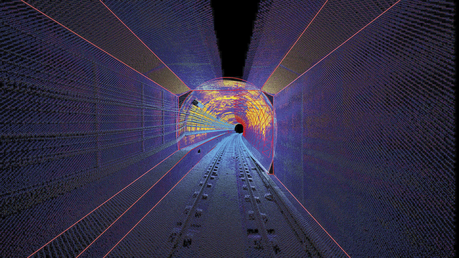
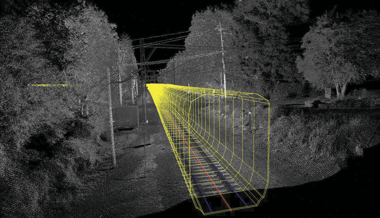
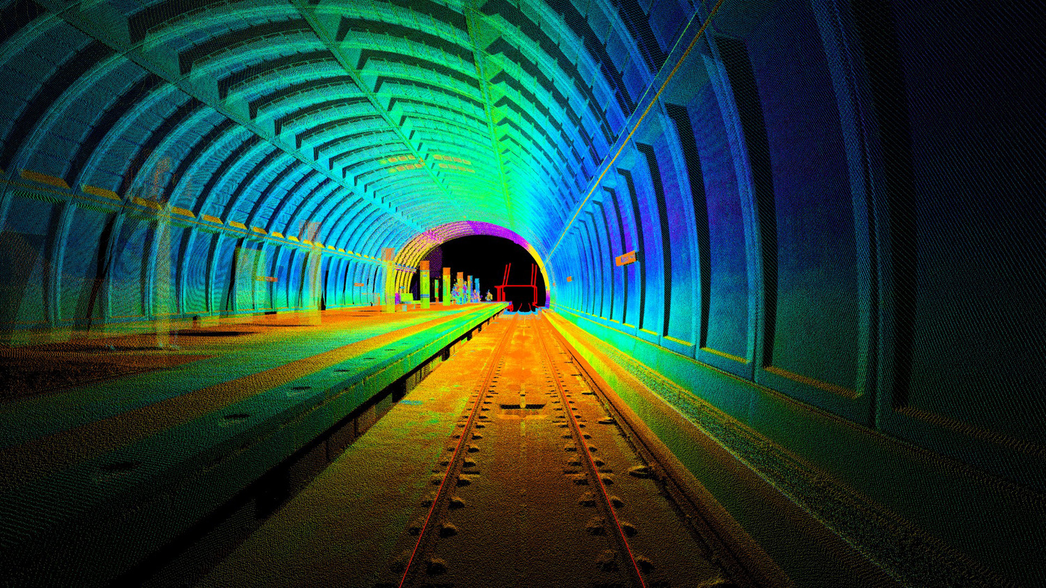
- Mobile LiDAR rail corridor mapping
- Right-of-way boundary surveys
- Topographic base mapping for rail infrastructure
- Direct fixated track construction support
- Positive train control and asset mapping
Our approach
Rail measurement requires specialized equipment and certified professionals. Our teams deploy high-precision geometry systems, robotic instrumentation, and mobile LiDAR platforms capable of collecting detailed track and corridor data efficiently and safely.
We integrate track geometry data with static LiDAR, GPS, and conventional survey methods to produce comprehensive datasets that capture alignment, clearance, and asset location. All field data is processed through disciplined quality control procedures to ensure compliance with project specifications and transit authority requirements.
SERVICES
- Land survey and measurement
- Mobile LiDAR mapping
- Subsurface utility engineering
- GIS asset management
- Right-of-way and land services
- Unmanned aerial systems (UAS)
Designing for safety, compliance, and operational continuity
Rail and tunnel projects often occur in active service environments. Our teams prioritize safety certifications and operational coordination to minimize disruption while maintaining strict data accuracy standards.
Whether verifying existing track geometry, supporting new construction, or conducting tunnel clearance assessments, we deliver reliable data that supports regulatory compliance, passenger safety, and long-term system performance.
Coordinated rail surveying for complex transportation systems
Rail projects intersect with civil engineering, structural design, utility coordination, and right-of-way management. At Colliers Engineering & Design, our rail specialists collaborate with surveyors, engineers, SUE professionals, and geospatial teams to ensure alignment between track conditions, infrastructure design, and corridor constraints.
This multidisciplinary coordination strengthens project predictability and supports seamless progression from planning through construction and ongoing operations.
Frequently asked questions
Rail track geometry measurement evaluates horizontal and vertical alignment, gauge, superelevation, and clearance conditions to ensure safe and compliant rail operations.
Mobile LiDAR systems are mounted on high-rail vehicles to collect detailed corridor and tunnel data at track speeds, producing highly accurate 3D spatial models.
Tunnel clearance surveys are required during rail upgrades, infrastructure modifications, rolling stock changes, and safety assessments to verify compliance with clearance standards.
Yes. Our teams are trained and certified to operate in active rail environments while maintaining strict safety and coordination protocols.
Let’s talk about your next project!
Our multidisciplinary approach to design, combined with a deep understanding of the industry and passion for innovation, has positioned us as leaders consistently delivering outstanding results in shaping the built environment.