Subsurface Utility Engineering
Utility investigation and mapping that reduces risk and protects infrastructure investment
Subsurface Utility Engineering (SUE) is critical to identifying, locating, and managing underground utilities before design and construction begin. At Colliers Engineering & Design, our SUE professionals combine engineering judgment, surveying expertise, and geophysical technology to provide accurate, standards-based utility data that reduces conflict and improves project safety.
We work across transportation, airports, rail corridors, utilities, energy facilities, ports, healthcare campuses, and private development projects to provide dependable subsurface insight that supports informed design decisions.
- Records research and utility data compilation
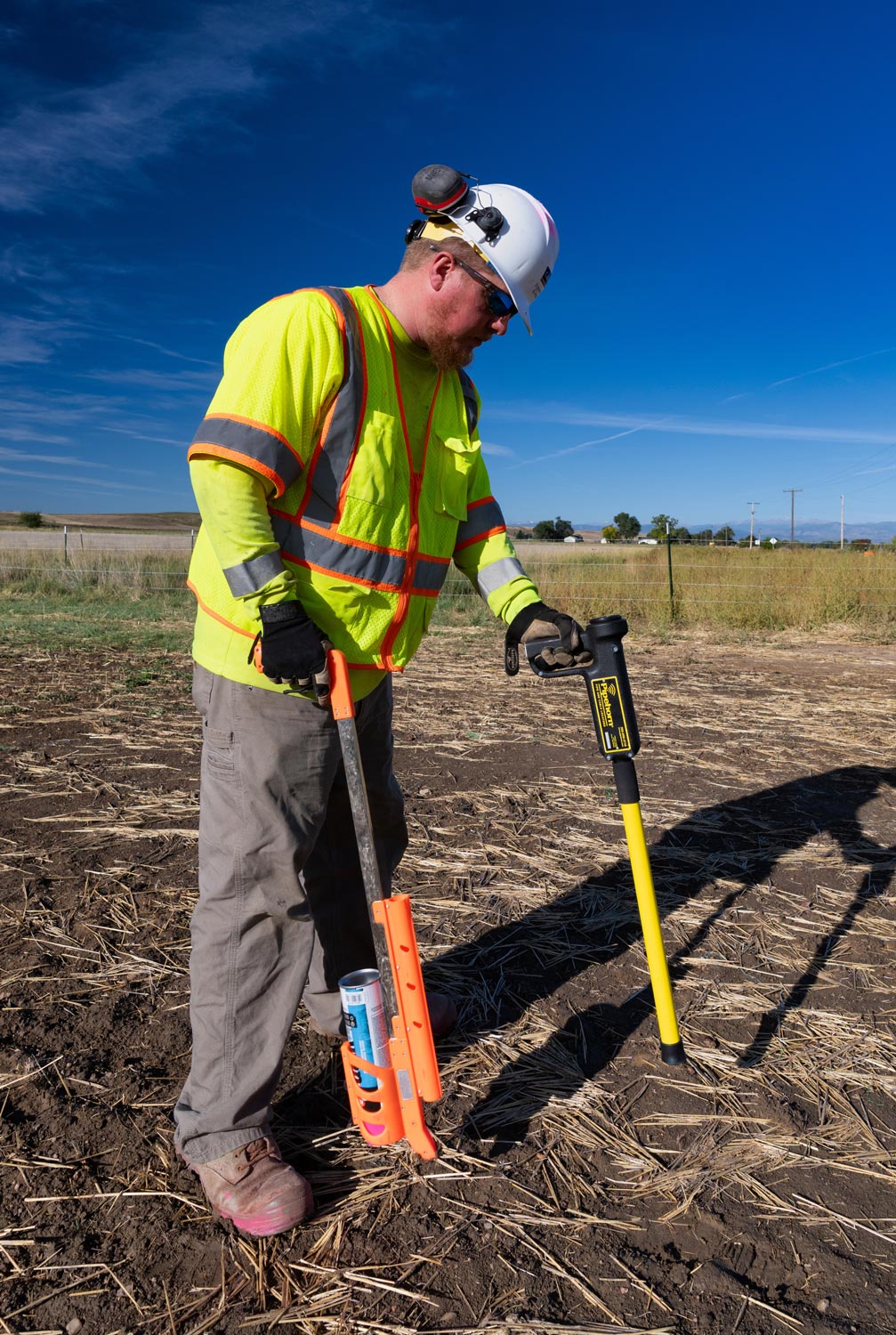
- Utility designation and horizontal mapping
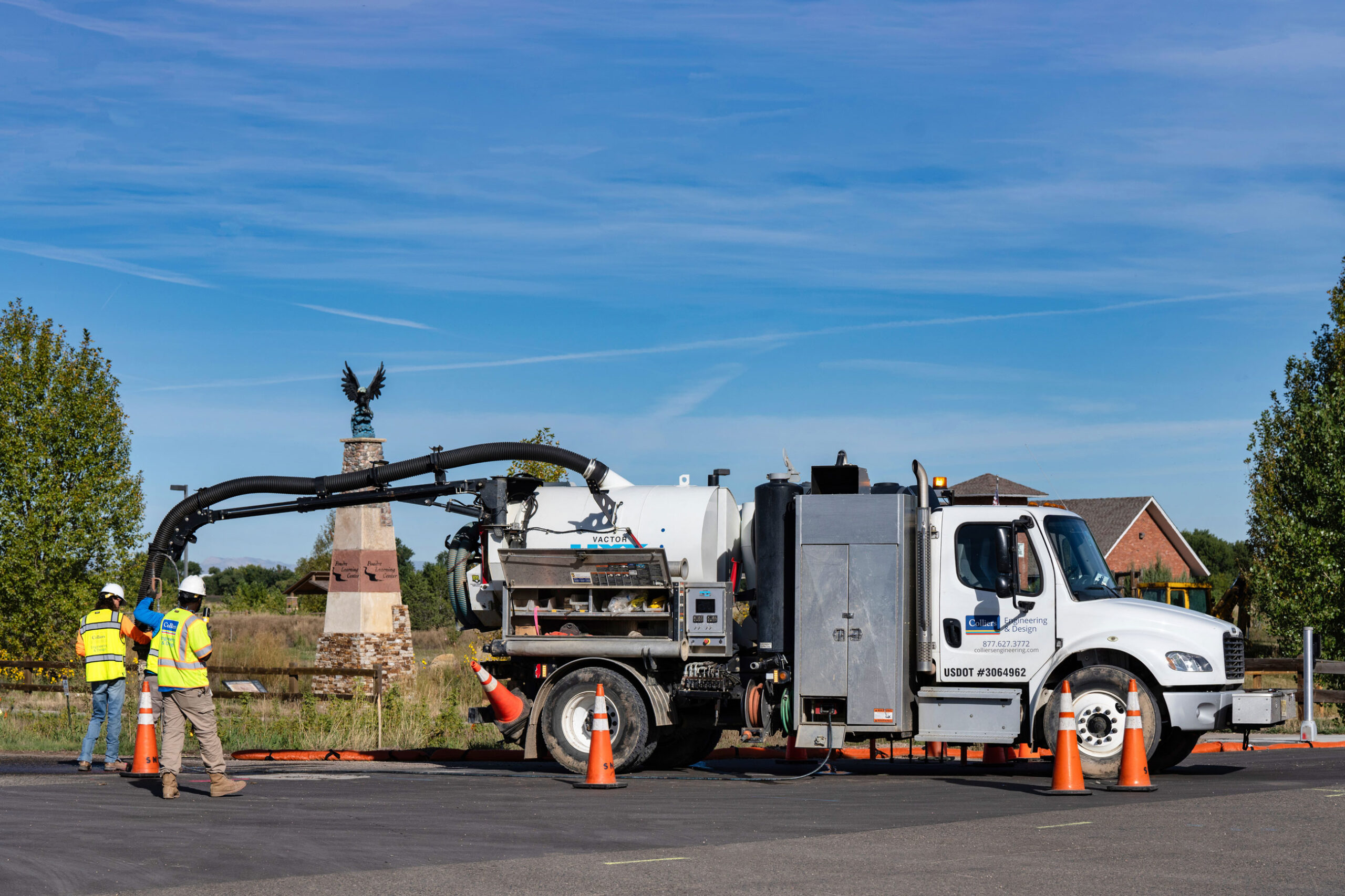
- Vacuum excavation and utility locating
- Ground penetrating radar (GPR) investigations
- Integrated existing utility survey deliverables
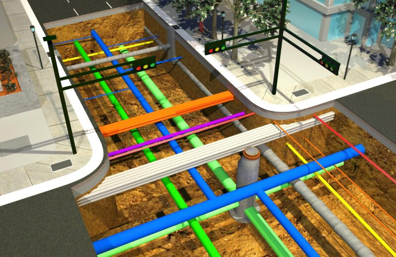
- 3D utility modeling and GIS integration
- Utility conflict identification and risk envelope mapping
- Excavation and drilling clearance support
Our approach
Effective SUE begins with structured investigation. We follow nationally recognized ASCE 38 and 75 guidelines for the collection and depiction of subsurface utility data, applying quality levels that combine records research, surface reconnaissance, geophysical locating, and non-destructive vacuum excavation.
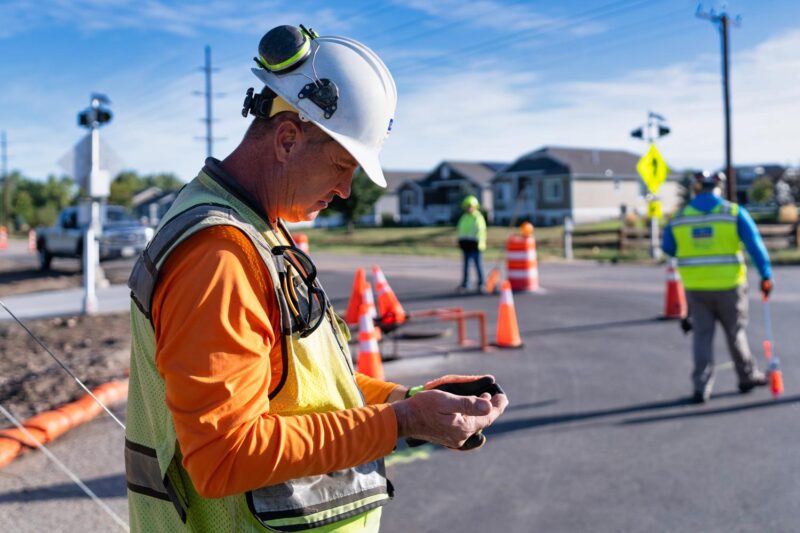
Our teams coordinate directly with engineers, surveyors, and utility owners to validate findings and integrate results into project design models. This disciplined process minimizes unexpected conflicts, reduces redesign risk, and enhances construction safety.
SERVICES
- Land survey and measurement
- LiDAR services
- GIS asset management
- Rail and tunnel measurement
- Right-of-way and land services
- Unmanned aerial systems (UAS)
Designing for safety, cost control, and conflict avoidance
Utility conflicts are among the leading causes of construction delays and cost overruns. Our SUE services provide the clarity needed to avoid unnecessary relocations, minimize damage to existing infrastructure, and protect public safety.
By delivering precise horizontal and vertical utility data early in the design process, we help clients make informed alignment decisions, phase construction strategically, and reduce exposure to claims and property damage.
Coordinated utility investigation for complex project environments
Subsurface utility conditions intersect with civil design, transportation planning, environmental permitting, and right-of-way acquisition. At Colliers Engineering & Design, our SUE professionals collaborate closely with surveyors, engineers, GIS specialists, and project managers to ensure underground data aligns with overall project objectives.
This multidisciplinary coordination strengthens communication, improves risk management, and supports seamless progression from planning through construction.
Frequently asked questions
SUE is a specialized engineering practice that identifies, designates, and locates underground utilities using records research, geophysical methods, and non-destructive excavation to reduce project risk.
ASCE quality levels define the reliability of utility data, ranging from Quality Level D (records research) to Quality Level A (precise horizontal and vertical location through vacuum excavation).
SUE is typically required for roadway reconstruction, utility relocation, airport projects, rail corridors, pipeline installations, and large-scale development where underground conflicts may impact design.
By identifying and mapping utilities before construction, SUE minimizes unexpected conflicts, reduces redesign costs, improves safety, and limits project delays.
Let’s talk about your next project!
Our multidisciplinary approach to design, combined with a deep understanding of the industry and passion for innovation, has positioned us as leaders consistently delivering outstanding results in shaping the built environment.