Various surveying techniques are available to provide railroads with the optimum survey results required to accommodate specific projects. Surveyors look at the project characteristics and anticipated project deliverables and recommend the appropriate surveying technique during the scoping phase of a project. Discussions focus on choosing a methodology that would enhance safety, produce the required accuracy, provide the required deliverables, improve schedule, and reduce cost.
Surveying Rail Facilities
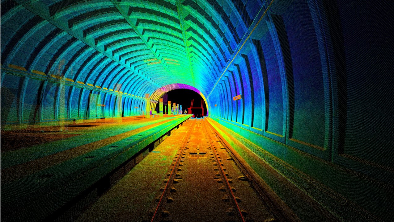
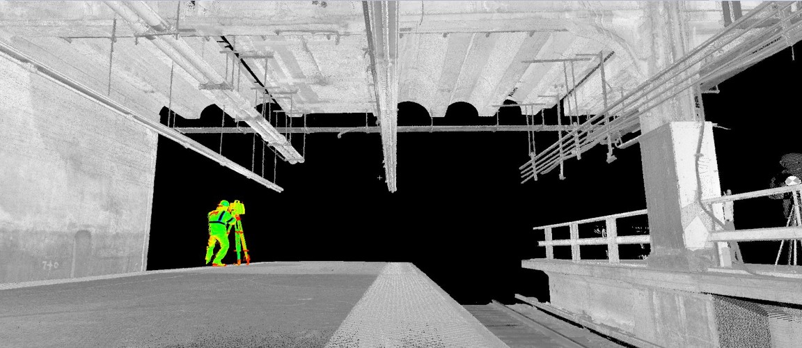
Static Scanning describes the use of a 3D hi-definition laser scanner that is stationary and is one of the most-used system in a toolbox of survey options. The scanner is set up at strategic locations at a project site to collect over a million points per second for the development of a 3D point cloud. It is most useful for safely scanning facilities, station platforms, stairwells, elevators, escalators, substations, shops, overhead utilities (like high tension wires that might be above the track), clearances, wayside objects, rail yards, and tunnel caverns. The 3D point cloud can be processed into 3D CADD files, digital terrain models (DTMs), BIM models, GIS and fly-through videos which would help engineers and architects perform their design.
Surveying Long Rail Corridors
Kinematic survey involves the use of survey equipment that collects data while in movement. LiDAR equipment can be attached to a hi-rail vehicle (mobile LiDAR) or mounted to a train to collect survey data along a freight or transit rail corridor. In addition, mobile LiDAR can be used to survey shared use roadway corridors that include streetcar routes. Like static scanning, 3D point clouds are created. Top of rail, overhead catenary systems, overhead utilities, traffic lights, bridges, and other features can be extracted to develop topographic maps and DTMs.
Mobile LiDAR can also be used to measure clearances between tracks, within tunnels, and between structures. 360-degree high resolution images, similar to Google Earth street-view, can be provided if needed. The accuracy for mobile LiDAR is typically 0.04-feet horizontally and vertically with survey control. Data can be collected at speeds up to approximately 70 MPH but are typically limited by hi-rail vehicle speeds.
Clearance and As-Built Surveys
Another form of kinematic survey is the use of an Amberg trolley to survey track in tight locations. This method can provide an accuracy of 0.01-feet horizontally and vertically, achievable with tight survey control. Manually pushed along the rail, the Amberg trolley is mounted with advanced survey equipment that surveys the track horizontal and vertical geometry, superelevation, and clearances. The survey data can be used to develop a regressed alignment, as-built conditions, and clash detection results for clearance studies using specific car body dynamic envelopes.
Surveying Using Unmanned Aircraft Systems (UAS)
Unmanned Aircraft Systems (UAS) performs LiDAR survey and aerial photography for short distances using a drone. Utilizing UAS for surveying railroads provides improved safety conditions, as surveyors can reduce the need to foul active tracks. UAS can also be used to assist in determining vegetation control measures, assist in grade crossing inventories, help in disaster recovery efforts (storms and derailments), and support track inspections. The typical UAS can be utilized for up to 60-minute flight times. They are flown by FAA Part 107 pilots, and licensed surveyors review the data and deliverables.
Determining Railroad Subgrade Conditions and Utility Location
Ground Penetrating Radar (GPR) uses technology to determine below-ground conditions. For railroads, GPR can be used to understand locations of fouled ballast and identify subsurface anomalies that negatively affect the stability of the subbase and ride quality. GPR can also be used to identify the locations of underground utilities. The GPR equipment can be manually controlled or attached to a hi-rail vehicle or train. GPR data, in conjunction with LiDAR data, can help identify drainage problems, settlement, depth of utilities and locations where resurfacing may be required.
Conventional Surveys
These survey techniques are used in conjunction with traditional conventional survey. Surveyors will need to use traditional methods to establish control, locate targets used for scanning, measure invert elevations, and survey features that were not in the line of sight when using a scanner, mobile LiDAR, or UAS. For some rail projects, the surveyor may recommend that only conventional survey would be the most efficient and safe methodology to employ based on the project characteristics.
For Your Project…
There are various options for surveying railroads and rail facilities. It is important to identify the needs and characteristics of the project during the scoping phase so the best surveying method is used. In many cases, a combination of surveying techniques may be employed, with careful consideration for creating a safe work environment.
Webinar Series
This article is part of our Webinar Blog Series. We turned directly to the experts who were excited to share their latest technologies, insights and strategies. If you have questions or would be interested in a Lunch and Learn about any of the topics covered, feel free to reach out to our presenters!
Want more information or a private presentation on this topic? Contact Kevin LaGreca at kevin.lagreca@colliersengineering.com.