Mobile LiDAR and its use for Curve Analysis
Have you ever wondered who sets the traffic speed limit on a roadway curve sign? You know, the ones you see as you drive along a winding road or off-ramp with a speed advisory on it. It points the direction and posts a recommended speed usually somewhere between 10 and 35mph. There is a science involved in determining this speed which is stated in the Manual on Uniform Traffic Control Devices (MUTCD) published by the Federal Highway Administration (FHWA).
In fact, the FWHA has established new criteria for compliance regarding safe speed curve signage that agencies need to comply with by December 31, 2019.
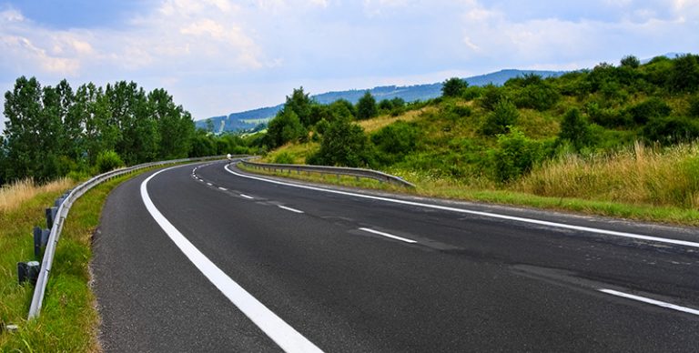
 Based on the curvature geometry and super-elevation, this safe speed limit has traditionally been determined using conventional, boots-on-the ground survey methods. However today, with the availability of mobile LiDAR scanning technology to collect this data, we can help DOT authorities evaluate the advisory speed curves with a higher rate of accuracy while making it safer for surveyors and engineers to perform and more cost effective. Scanning at a rate of over 1 million points per second, LiDAR detects every possible deviation in the pavement and other details that could affect the recommended speed limit—or further confirm it.
Since mobile LiDAR scans record virtually everything in its path, data about your other existing assets are captured in the scan as well. Information contained in the scan about assets like ADA ramps, bridge clearances, guide rails, and pavement markings can all be extracted and used at a later date for other projects. In many cases, mobile LiDAR data has been collected for various design or planning projects. Data re-use is a real possibility for analyses like this.
Paul DiGiacobbe, PE, DBIA, Director of Maser Consulting’s Geospatial Services, recently presented on this subject at TEAMFL’s “Roads of Opportunity” Conference in Orlando. The presentation, entitled “Utilizing LiDAR Data as an Innovative Tool for Roadway Curve Safety Analysis”, focused on the evolution of the advisory speed curve application and discussed the process, safety, reduced liability on DOTs, and efficiency gain (20:1) that using Mobile LiDAR produces in comparison to conventional survey methods.
A technical paper by the same name was accepted for publication by the Transportation Research Board (TRB) and authored by Paul and colleagues Ashwin B. Patel, P.E., District Traffic Engineer for the PA Department of Transportation; Ted Knaak, President of Certainty 3D (Makers of TopoDOT LiDAR processing software) ; and Nikhil (Nik) R. Kharva, P.E., PTOE, Senior Project Engineer at the HNTB Corporation.
Paul can be reached at pdigiacobbe@maserconsulting.com.
To view their technical paper, Utilizing LiDAR Data as an Innovative Tool for Roadway Curve Safety Analysis, published by the TRB, click here.
Comments are closed.