
 What is GIS?
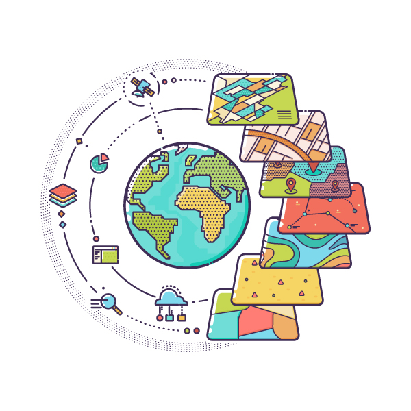
A geographic information system (GIS) is a framework for gathering, managing, and analyzing data. It integrates many types of data. It’s rooted in the science of geography and is an extension of cartography – the science of making maps. According to Discipline Leader of GIS Asset Management Services Suzanne Zitzman, it’s built on a system of map layers. These layers then allow users to plot, create, and visualize collected data as a map.
Think of the earth and all its features that make up our planet. Zoom in for a closer look. Maybe on your childhood street or the building you’re in now. Imagine clicking on that street and receiving real-time data on the last time it was paved or who owns it. Imagine all of this information at your fingertips on your computer, smart phone or iPad. Now, that’s the beauty of GIS.
The History of GIS
The first applicable concept of GIS was in the 1800s. Charles Picquet created an early version of a heat map representing cholera outbreak across the 48 districts of Paris. However, the first formal concept was introduced in the early 1960s when it was researched and developed as a new discipline. Throughout the 1970s, there was an emphasis on developing the practice, and by the 1980s there was an intense focus on improving the technology.
Prior to the 1980’s, drafting techniques were used to draw “to-scale” maps on surface and subsurface features. As the maps were hand-drawn, corresponding tables were typed out, showing coordinate locations (x,y,z) of the map feature, information related to the size of a pipe, or address of a building. These maps and tables would then be stored in a manageable fashion: either rolled up in tubes or in space-eating flat-files.

The 1980’s brought more than shoulder pads and leg warmers. It brought a revolution in software development and technological techniques currently used in the GIS industry. Global Positioning System (GPS), assists GIS program administrators in creating highly accurate digital mapping. This mapping is then used by emergency responders, utility service teams, and public transportation agencies.
During this time, Environmental Systems Research Institute (Esri), an international supplier of Geographic Information System software, introduced its first international user conferences. This was one of the many factors that helped further the development of the technology by connecting people and ideas globally.
What Does it Do?
GIS is a web-based tool that accurately locates assets. Then, it enables you to log specific details of each asset from model number to maintenance schedule. Over the long run, this helps asset managers make informative decisions; like when and how often they should be replaced or serviced.

Local governments own a variety of assets the public uses: parks, parking lots, schools, and sanitary sewer systems. These authorities have a responsibility to maintain the operation and standards of these assets to ensure a safe environment for their community. This system enables them to do that.
By keeping track of maintenance work, costs of rep air, and results of condition inspections within the program, information can be viewed across multiple assets to find the features most likely to fail or have the poorest inspection results. Relating this scenario to a failing park swing set, or a pedestrian foot bridge, you can see the value of information a GIS program holds for people who are responsible for these assets.
How Accurate is the Data?
GPS is a space-based radio navigation system that provides geolocation and time information to a GPS receiver. GPS is also a component of the Global Navigation Satellite System (GNSS). This also includes other satellite navigation systems. “Because GIS utilizes GPS, you can tag an asset in the GIS program with a 1-centimeter accuracy while utilizing high accuracy receivers compatible with GNSS,” says GIS Technician Samuel Firmenich. The current New Jersey Department of Environmental Protection (NJDEP) horizontal accuracy standard for locations determined through GPS is within 5 meters. “It’s safe to say this information is quite accurate.”
Today’s GIS programs are web-based and mobile device friendly. GPS enables the users to use something as simple as an iPad to collect and send data to a secure web server in real time. This is made possible by an external antenna that connects to your device via Bluetooth.
How it Benefits You
GIS is most likely used in our every day lives… whether or not we know it. The system is beneficial for urban planning, transportation planning, land use planning, surveying, community development, regional planning among others.
The system can represent the growth of a city in select neighborhoods over the course of a specific time period. By recognizing growth patterns, cities can be proactive instead of reactive for development purposes.
The Future of GIS
With so many organizations tracking their assets location and conditions, it only makes sense these programs will talk to each other. The programs have no geographic boundary which creates spatial awareness across an array of asset types and regions.
The autonomous vehicle industry thrives on spatial awareness, and GIS is the place where spatial awareness resides. Edge of roadways, intersections, signalization are all key assets mapped at high accuracy, driving the path of autonomous vehicles.
Now that we’ve learned how this program can benefit municipalities, organizations, and even means of transportation, the verdict is in: the future of GIS is bright.

This blog post was created in collaboration with Suzanne Zitzman.
Also Read:
https://colliersengineering.com/gis-water-quality-accountability-act/
Sources: