Colliers Engineering & Design utilizes cutting-edge, geospatial data collection modalities to capture a large amount of high-quality LiDAR data and imagery of complex interior and exterior building sites. Having the capability of putting real-time, digital data directly into the hands of clients gives them an unprecedented ability to plan for future expansions; utility and equipment routing; asset inventory contained within a structure; and proof of concept/clash detection with proposed models.
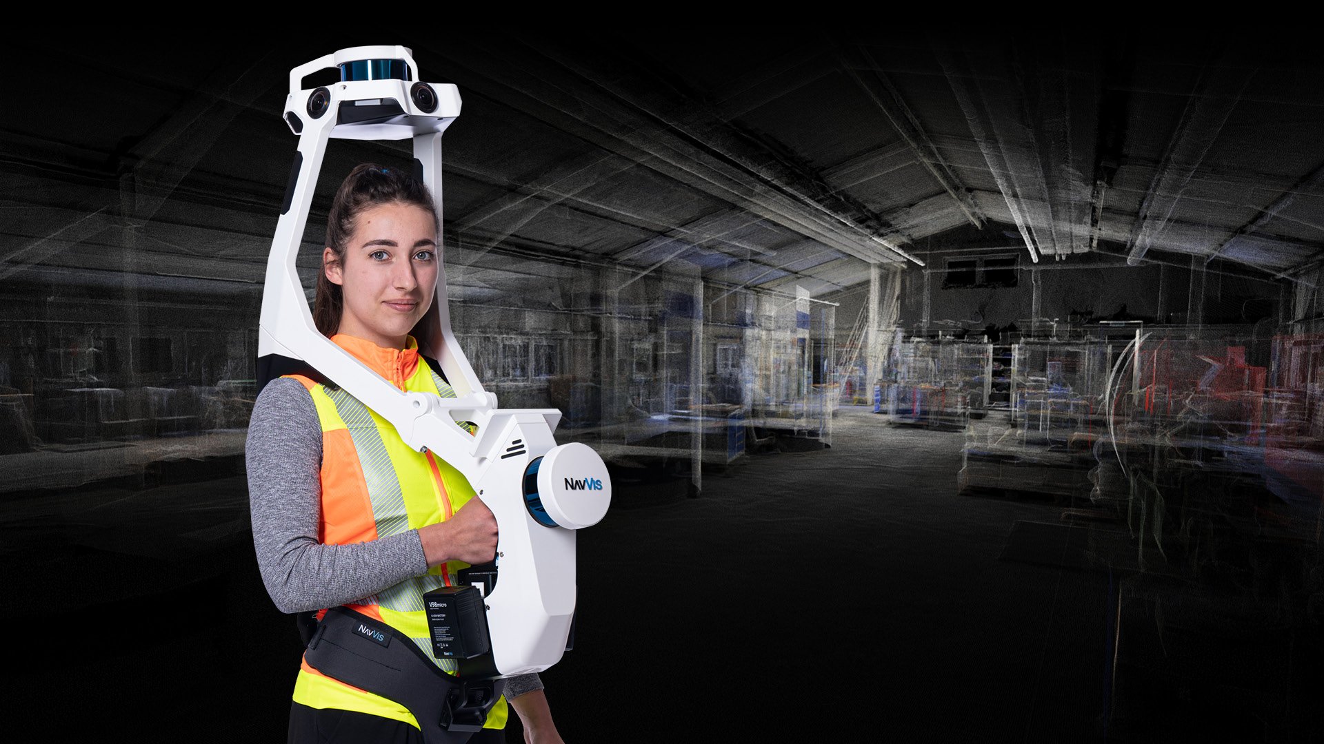
The NavVis VLX indoor mobile mapping system (IMMS) is a transportable, end-to-end, reality capture solution, that delivers survey-grade point clouds enabling us to scan and store every detail about a building simply by walking through the space. This can be used for complete 360-degree image capture; Digital Twin Technology; rapid as-builts for interior or exteriors; historic preservation; asset and facility management and transportation hubs including air, rail, and ports.
This rapid turnaround time for deliverables offers high-resolution immersive imagery; intuitive 3D viewer; desktop viewing for inspection; monitoring of project progress and recording of assets. This equates to enabling our clients and partners to have real-time decision-making about their projects.
The deliverables afforded by the NavVis technology are the benefits of having an immersive 3D viewer with measurement tools which gives the client turnkey floorplans & 3D Building Information Models (BIMs).
The connected software interface provides the basis to create highly accurate, 3D BIMs using a Scan-to-BIM process. 3D BIMs can be effectively utilized to generate or confirm data throughout the building lifecycle for new projects as well as existing projects and build-outs. The development of 3D BIMs also facilitates the implementation of Digital Twin methodologies.
Knowing there is always a right tool for a specific job, our motivated professionals are continually refining the process, evaluating, and harnessing new technologies and applications as they become available. Our multi-software platform approach includes many different specialized applications to create highly accurate BIMs.
We employ the following data collection methods to create BIMs:
- Indoor Mobile Mapping (IMMS)
- Static LiDAR (TLS)
- Mobile LiDAR (MMS)
- Aerial LiDAR & Imagery (UAS)
Having the ability to make immediate decisions about your project workflow, progress and changes in the field can result in an accelerated time to market and success of your project’s outcome. Our approach enables us to offer these services at competitive prices, with accelerated turnaround times to deliver maximum value to the client.