What Actually Is Hydrographic/Bathymetric Surveying?
When most people think of Texas, they might think of cowboys and wide-open land. What most don’t know is that approximately 367 miles of Texas’ southern border is coastline along the Gulf of Mexico. The Lone Star State also has an estimated 15 major rivers and over 150 reservoirs and natural lakes, all playing a crucial role in the state’s ecosystems, water supply, and recreational activities.
Given the expansive coastline and numerous inland waterways, hydrographic and bathymetric surveys are essential for industries like maritime navigation, environmental research and resource exploration.
So…What Exactly Is Hydrographic/Bathymetric Surveying?
Matthew D. Jones, RPLS, Survey/Geospatial Geographic Discipline Leader at Colliers Engineering & Design in Texas explained that hydrography, or seafloor mapping, is a geophysical science that measures physical features of bodies of water and adjacent land. Bathymetry is a type of hydrography, specifically measuring the depth of the sea floor.
Jones further explained that while sometimes the words hydrographic and bathymetric are used interchangeably, the difference between the two types of surveys lies in their focus: hydrographic surveys map water topography, shorelines, and hazards using sonar and GPS, crucial for navigation and maritime safety. Bathymetric surveys concentrate on water depth, providing detailed information about underwater topography. Utilizing sonar and other tools, bathymetric surveys are valuable for environmental studies, geological research, resource exploration and understanding ocean floor topography.
What Are These Surveys Used For?
Have you ever gone to a beach and returned years later only to find that the beach has seemingly disappeared? Jones explained that this natural destruction of coastlines by tidal forces and extreme weather conditions is called coastal or beach erosion, and detailed hydrographic surveys can provide an insight into why and how this occurs.
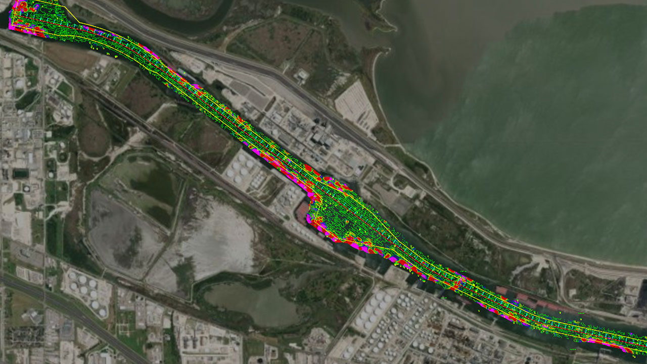
Hydrographic and bathymetric surveys are also used for dredging and marine construction. In Texas, they help monitor changes in the seafloor, coastline, and water depths, providing valuable information for coastal erosion studies, sediment transport analysis and overall coastal resilience planning. The ports along the Texas coast are major gateways for maritime trade. Bathymetric surveys aid in maintaining navigational channels by assessing sedimentation and ensuring sufficient water depths for safe vessel navigation. Dredging projects often rely on accurate bathymetric data to optimize channel depths, which Jones and his team provide.
Texas is also a significant player in the oil and gas industry, and bathymetric surveys are employed in offshore areas for oil and gas exploration. These surveys contribute to understanding the underwater geological features, identifying potential drilling sites, and ensuring the safety of offshore infrastructure. Inland water bodies, such as rivers and reservoirs, benefit from bathymetric surveys for environmental monitoring. These surveys assist in assessing the impact of human activities, studying sedimentation patterns, and maintaining water quality.
Texas experiences periodic flooding, and bathymetric surveys aid in mapping floodplains. Accurate elevation data of riverbeds and other water bodies contribute to flood risk assessment, emergency preparedness, and the development of effective floodplain management strategies. Bathymetric surveys can also provide insights into the underwater habitats and ecosystems along the Texas coast. Understanding the seafloor topography is essential for ecological studies, habitat mapping, and conservation efforts to protect marine biodiversity.
Lastly, as Texas continues to grow, bathymetric surveys support infrastructure planning, including the design and construction of bridges, causeways, and other structures that interact with water bodies. Accurate underwater mapping ensures the stability and longevity of these projects.
In summary, bathymetric surveying in Texas serves a diverse range of applications, contributing to coastal resilience, maritime navigation, environmental conservation, and the sustainable development of both coastal and inland water resources, Jones explained.
How Does This Work?
Taking a look at the history of hydrography, single-beam sonar systems were first used in the early 1930s to make hydrographic and bathymetric maps, sending a single sound beam straight down to the seafloor, providing depth information along a single line. Sonar, which stands for Sound Navigation and Ranging, involves sending sound waves into the water and measuring the time it takes for them to bounce back. By analyzing the return signals, surveyors can determine the depth of the water at specific points.
Today, Jones explained that these surveyors typically use multibeam sonar technology, which uses multiple beams arranged in a fan-like configuration to capture a wide swath of the seafloor simultaneously. In some cases, bathymetric surveys may also incorporate LiDAR (Light Detection and Ranging) technology. LiDAR uses laser beams to measure distances and create detailed elevation models. While more commonly used on land, underwater multi-beam sonar can be employed to enhance the accuracy of bathymetric surveys in certain environments. Surveyors also use devices called echo sounders, or devices that release sound pulses and measure the time it takes for the echoes to return. They are a key component of sonar systems used in bathymetric surveys. The data collected from these echoes help create depth profiles and seafloor maps.
Global Positioning System (GPS) technology is another crucial component of bathymetric surveys that is integrated to precisely locate the position of the survey vessel. This ensures that the depth measurements are accurately geo-referenced, allowing for the creation of detailed maps. The collected sonar data is processed to remove noise and artifacts, and advanced software is used to create detailed bathymetric maps and 3D models of the seafloor. These maps provide information not only on the depth but also on the shape and features of the underwater terrain.
What Are The Challenges?
It’s no question that what lies beneath the water is a mystery to most. In fact, according to the National Oceanic and Atmospheric Administration (NOAA), more than 80% of the ocean remains unexplored. With specialized technology like LiDAR and underwater 3D sonars, there are always a certain number of challenges that are associated with it. When you factor in all of the different types of technology, as well as the different processing software that companies use, it can be extremely difficult to collect and provide accurate data. Along those same lines, Jones explained, is the ability to capture accurate data while running multiple sensors at a time that are all collecting multiple data sets.
“It takes a lot of hands-on experience to know what you’re looking at in order to take the data that we’ve collected, process it using specialized software, analyze the data, and then clean it and interpret it to provide visualizations of our findings,” shared Jones.
What’s On The Horizon?
“Coastal counties of the U.S. are home to over 128 million people, or almost 40 percent of the nation’s total population,” according to NOAA. That means that 40 percent of the population relies on surveyors like Jones and his team to provide the most accurate data to clients to keep local communities, like in Texas, safe. The future of bathymetric surveying holds exciting possibilities as advancements in technology continue to reshape the field, including increased automation, the integration of Artificial Intelligence (AI), the combination of technologies, such as combining sonar data with other remote sensing techniques like satellite imagery or LiDAR, and even the expansion of applications of bathymetric surveys. As environmental concerns grow, bathymetric surveying is expected to play a crucial role in monitoring and conserving underwater ecosystems. Understanding changes in underwater habitats, detecting pollution, and assessing the impact of human activities on aquatic environments will become increasingly important, and Jones is excited about what that means for his team and their capabilities.