
-
Surveying Substations with LiDAR
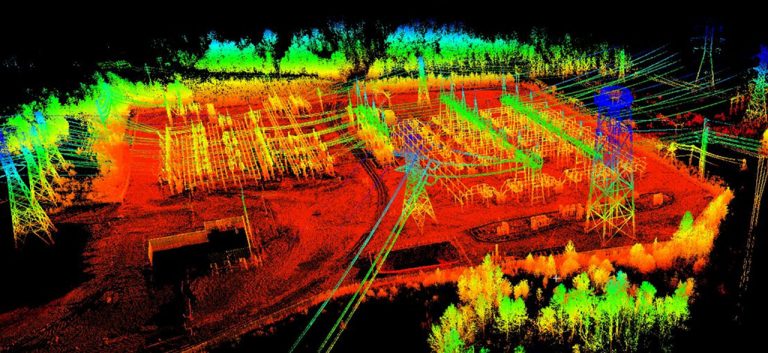
Surveying Substations Surveying substations is complicated. And believe it or not, conventional survey can increase the complexity. So, what are your options? Well, they all revolve around the use of LiDAR! But... ... Read More
-
Building Information Modeling (BIM)
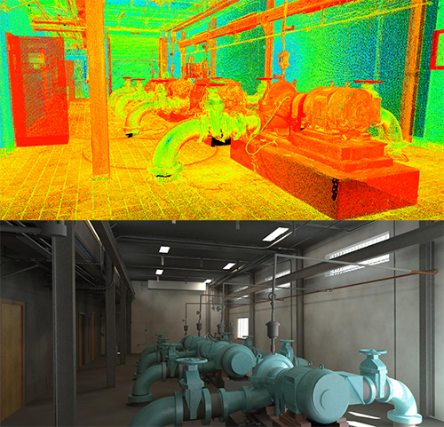
What is BIM, and why should you implement it into your architecture, engineering, and survey plans? BIM, or “Building Information Modeling” is a process of building highly accurate, measurable 3D models that... ... Read More
-
A Look at GIS: You’ve Come a Long Way, Baby!
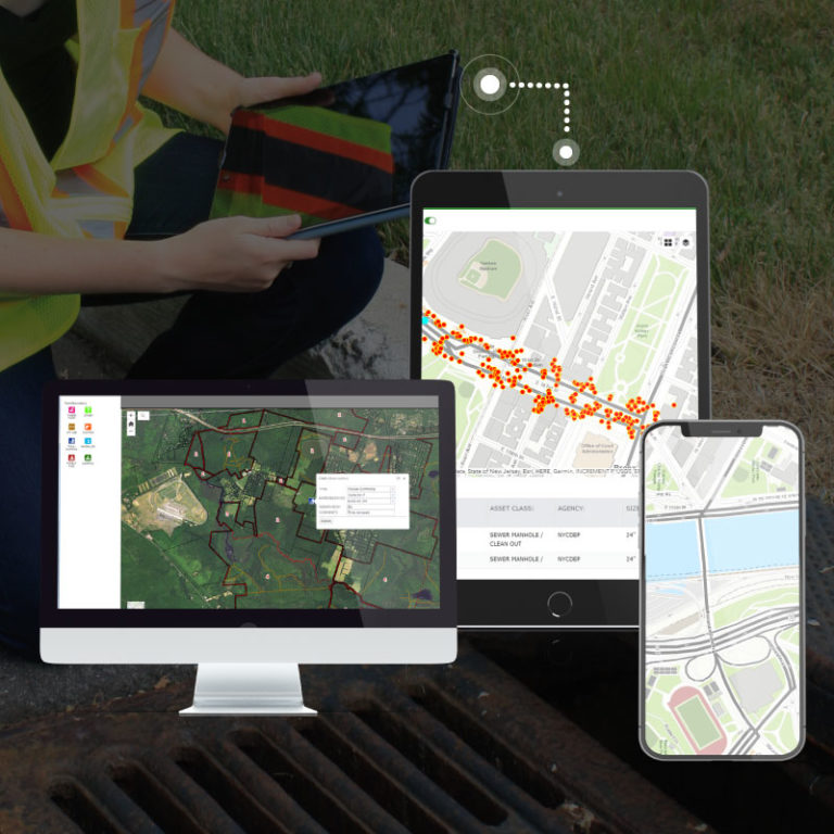
Discover and learn how a GIS program can help organize the management of key infrastructure assets! [vc_row][vc_column][vc_video link=”https://youtu.be/cftVlMekXno”][/vc_column][/vc_row][vc_row][vc_column][vc_column_text] Geographic Information Systems. Think about it. GIS locates assets in the field with Global... ... Read More
-
Frontline Workers Say “Call Before You Dig”

811, Know Before You Dig We all know that we’re surrounded by utilities. But we don’t often think about how many of them are out of sight, underground. Whether you are a... ... Read More
-
Maintaining Pipe Casing Integrity
Because gas or oil pipelines tend to be buried in soil or immersed in water, they are prone to corrosion. As such, statutes 192.467 and 195.575 from the United States Department of... ... Read More
-
ADA Ramp Compliance
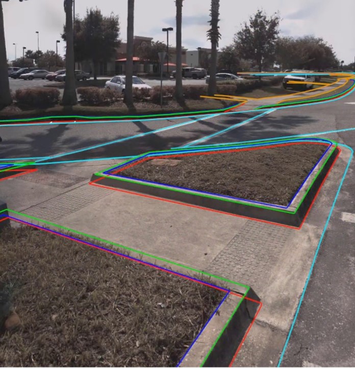
Thanks to the Americans with Disabilities Act (ADA), our country has come a long way in creating more inclusive spaces. One such way of doing so is with Title II. It provides... ... Read More