As the largest provider of mobile mapping services in New Mexico and the Southwest, we are deeply vested in providing dynamic survey, mapping and consulting support relating to transportation and corridor project development. Our team is versed in methods and approach used by Departments of Transportation, primary consultants, statewide on-call contracts and Native Land clients. Because this is a mobile service, our teams can easily be deployed anywhere across the state, region and nation.
Our services in New Mexico have evolved over eight years to from providing LiDAR data management to include Conventional Survey, Right-of-Way Mapping, Subsurface Utility Engineering and Utility Coordination. This has created strong partnerships, oversight and data management services within local municipalities, state agencies and consultant ranks.
- Aerial Remote Sensing
- Cultural Resources
- Fixed-wing Aerial Mapping
- Geospatial Program Development & Management
- Geospatial Survey
- Land Use Planning
- Mobile/Aerial Hybrid Modeling
- Mobile LiDAR
- Natural Resources
- Scan to BIM
- Subsurface Utility Engineering
- Telecommunications
- Terrestrial Mapping
- Utility Coordination
![C-Wygant C-Wygant](https://colliersengineering.com/wp-content/uploads/elementor/thumbs/C-Wygant-qddxgv4eejeyjnil7l8bybytl6a02mxqypa59knd1s.png)
Meet your local contact
Clay Wygant, PLS
Geographic Discipline Leader – Survey/Geospatial
![NMDOT I-25 and US-491 LiDAR Scan](https://colliersengineering.com/wp-content/uploads/2019/10/NMDOT-I-25-and-US-491-LiDAR-Scanning-Maser-Consulting-1.jpg)
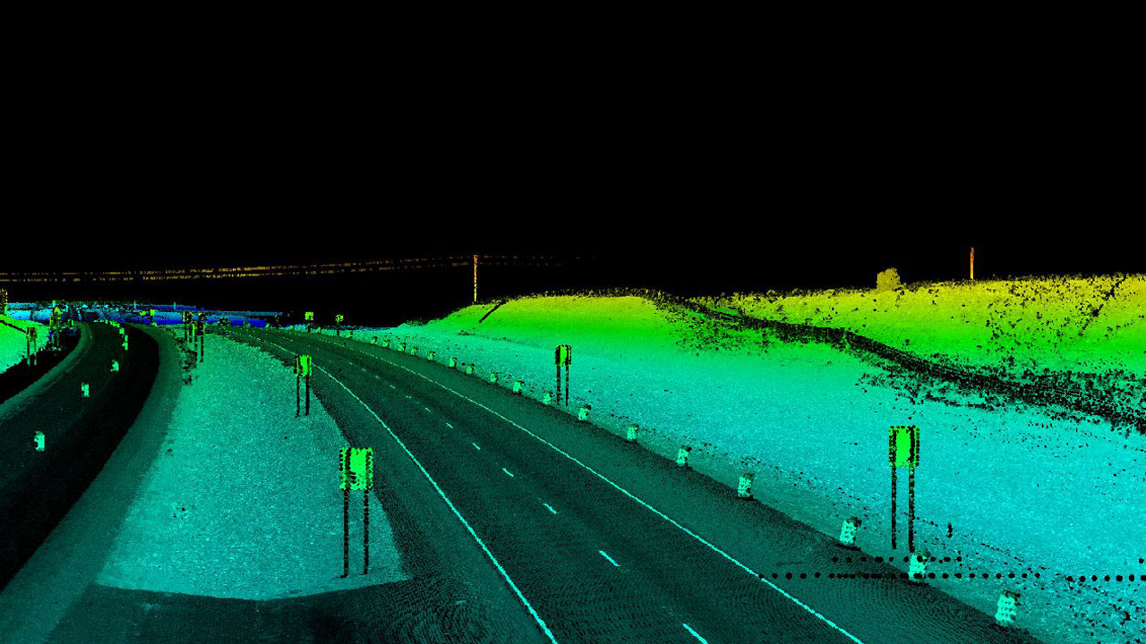
NMDOT I-25 and US-491 LiDAR Scanning
Colliers Engineering & Design performed design-grade mobile LiDAR scanning for several New Mexico Department of Transportation Full Depth Reclamation projects on US-491 north of Gallup and I-25 between Los Lunas and Belen.
![NMDOT US 82/NM 83 LiDAR scan](https://colliersengineering.com/wp-content/uploads/2019/10/NMDOT-ADA-Improvement-Project-Maser-Consulting.jpg)
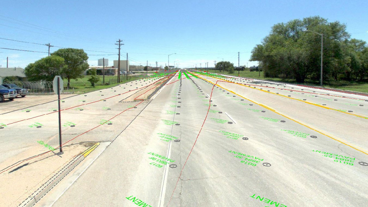
NMDOT US 82/NM 83 ADA Improvement Project
As part of the ongoing New Mexico Department of Transportation Road Construction Project, Colliers Engineering & Design provided mapping services for the City of Lovington for ADA and driveway turnout improvements. The
![NMDOT Grand Avenue LiDAR scan](https://colliersengineering.com/wp-content/uploads/2019/10/NMDOT-Grand-Avenue-LiDAR-Scanning-Maser-Consulting.jpg)
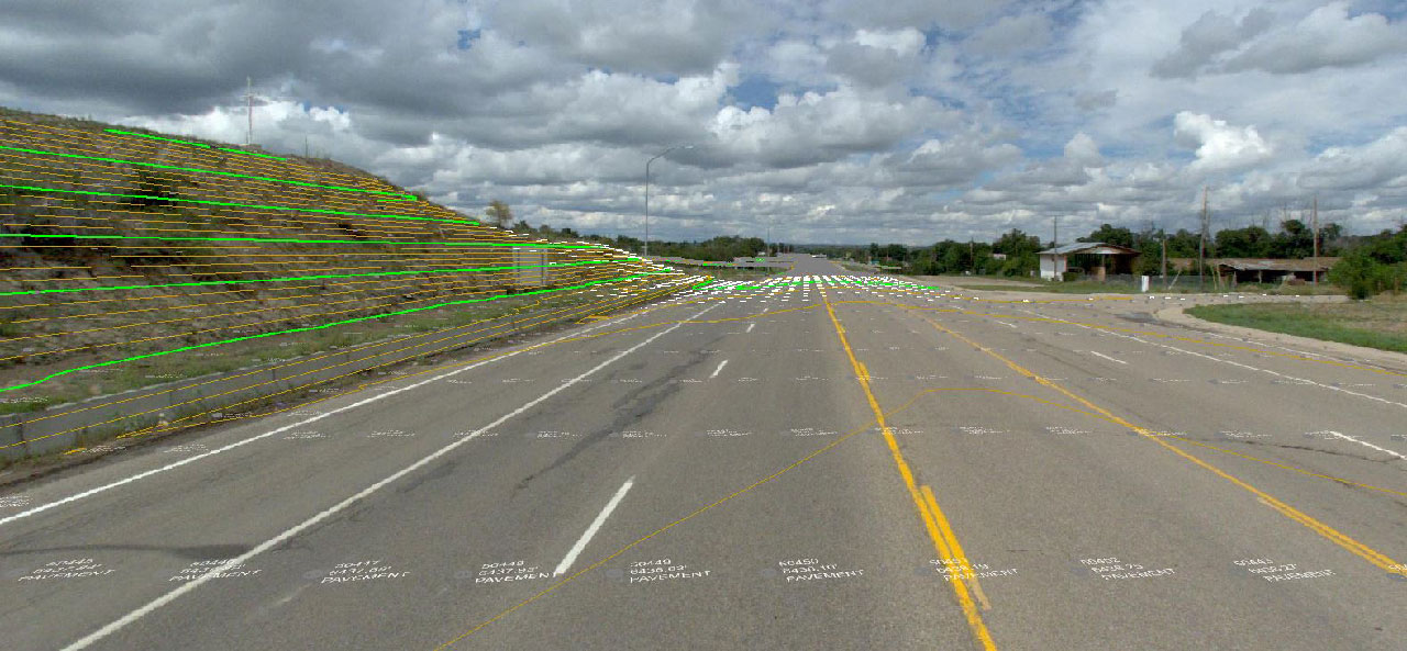
NMDOT Grand Avenue LiDAR Scanning & Mapping
Colliers Engineering & Design conducted a design-grade mobile LiDAR scan of approximately two miles of Grand Avenue in Las Vegas, including intersecting side streets within the project limits. The LiDAR data set
![](https://colliersengineering.com/wp-content/uploads/2024/07/Bryan-Texas-New-Hire-Post_NEW-V2.jpg)
Expanding our Municipal Team in Bryan, TX
Colliers Engineering & Design’s presence across the Lone Star State has been expanding, and our municipal team in Bryan, TX is growing alongside it. Two full-time hires and one summer intern are
![](https://colliersengineering.com/wp-content/uploads/2024/03/Hydro-Bath-Landing-Hero-Image.jpg)
What Actually Is Hydrographic/Bathymetric Surveying?
Read how Hydrographic/Bathymetric Surveying maps water features using sonar and GPS, crucial for navigation, research, and conservation.
![](https://colliersengineering.com/wp-content/uploads/2024/03/Howard-ECE-1280x720-1.jpg)
Grant Writing with Kelsey Howard
Read how Grant Writing Manager Kelsey Howard has secured over $194 million for projects, including a multimillion-dollar grant for flood mitigation in Highlands, NJ.