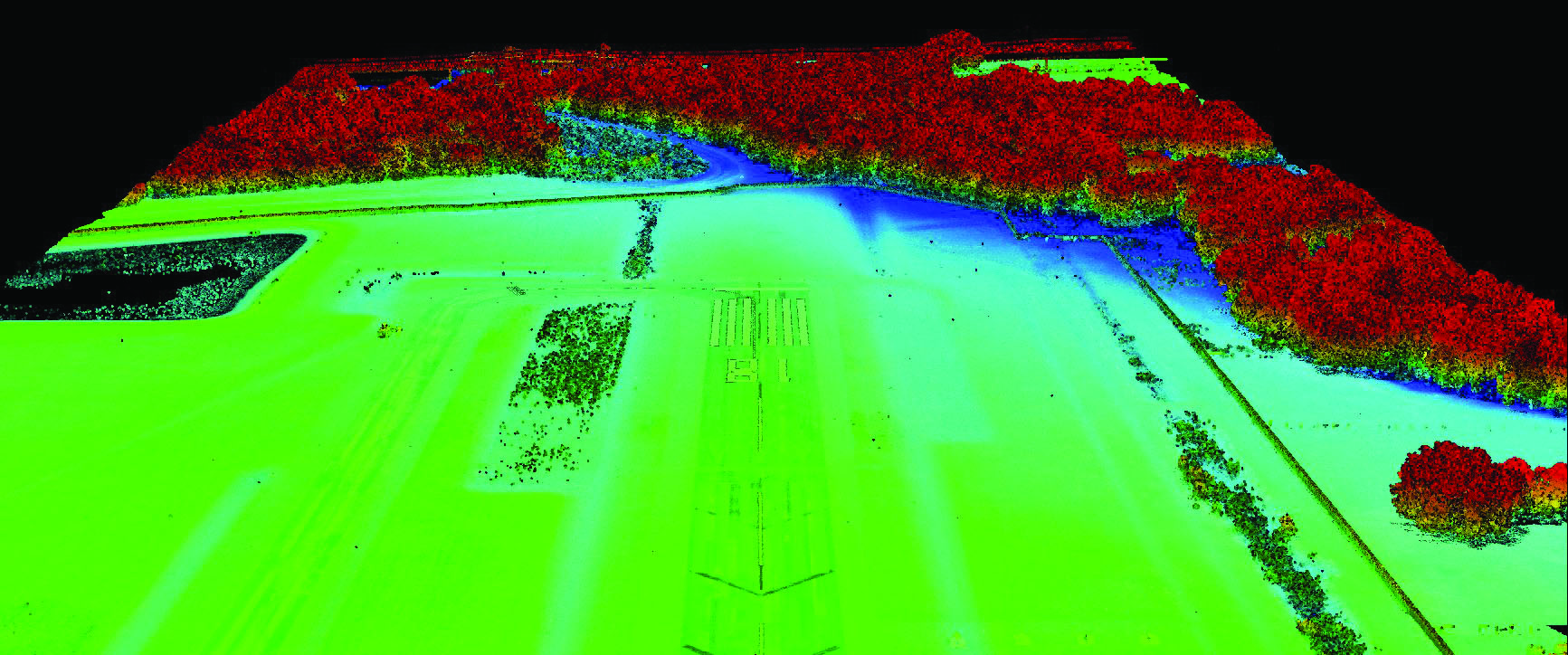
Colliers Engineering & Design provided the Wauchula Municipal Airport survey services to assist the airport in updating the design of its Precision Approach Path Indicator (PAPI) light system. PAPI lights are a light array positioned adjacent to the runway that give an approaching aircraft a visual indication of the its position relative to the designated alignment and glideslope for the runway. Maser Consulted was contracted to perform a UAS LiDAR survey of the approach paths to the runway. Wetland areas had been identified in the flight path at both ends of the runway, so one of the project challenges was to ensure proper sight lines while simultaneously limiting impact to wetland vegetation. In addition, one of our FAA Part 107 licensed UAS pilots coordinated with airport management in filing all necessary notices for safe operations.
The Vapor55 UAS platform, coupled with our Riegl VUX LiDAR sensor, enabled lower-altitude flights compared to the traditional fixed-wing LiDAR, resulting in a much denser point cloud. Consequently, this allowed the project team to create an accurate model of the top of the tree canopy and identify specific trees that might impact sight lines. The final result of the project included an updated PAPI system with clear sight lines to aid in approach navigation, with minimal impact to identified environmental wetlands.