Thurlow Dam
City of Tallassee, Elmore County, AL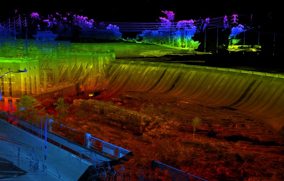
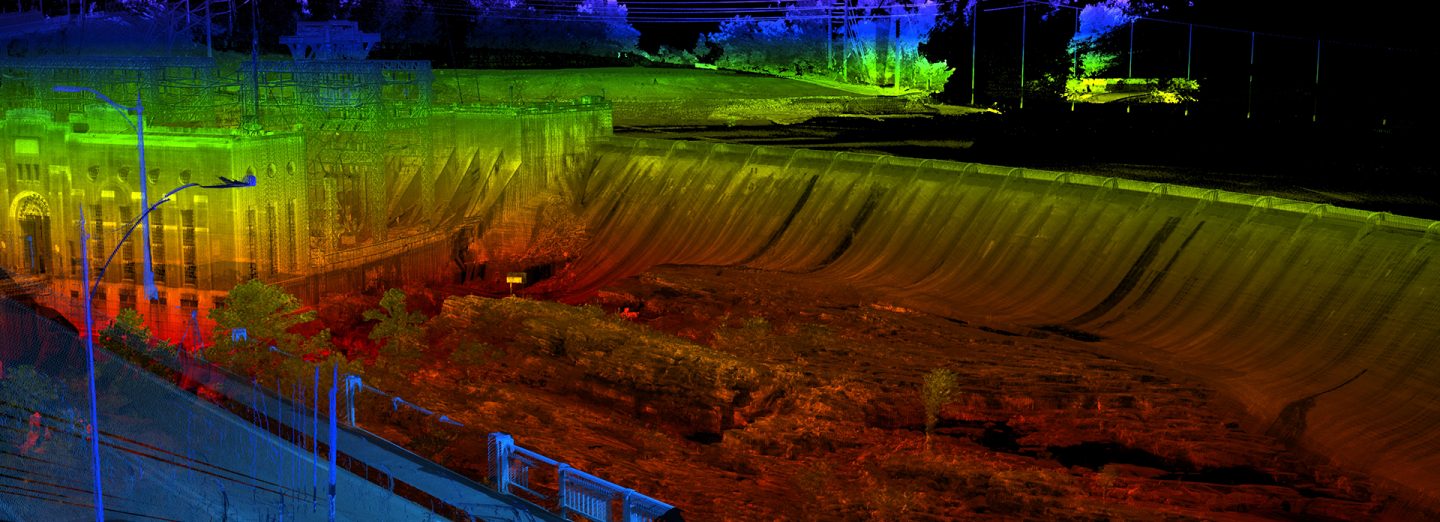
Colliers Engineering & Design was contracted by HDR Engineering to provide Unmanned Aerial System (UAS) mapping of the Thurlow Dam, located in Tallassee, Alabama. The Alabama Power Company’s dam is nearly 100 years old and will undergo reconstruction of the control gates across the top of the 1,000-foot +/- wide spillway and improvements at the powerhouse near the gantry crane. Because the most recent available record of the gates and powerhouse were from 1927, a detailed 3D survey needed to be completed in order to accommodate the new construction.
Colliers Engineering & Design closely collaborated with HDR and the Alabama Power Company to develop a schedule for reservoir draw down without affecting hydroelectric operations within the system. The water level draw down allowed the UAS LiDAR to capture portions of the upstream dam face normally inundated with water. We utilized conventional ground survey, terrestrial LiDAR scanning (TLS) and UAS LiDAR to provide unparalleled, high-resolution mapping detail for this complex survey of aging critical infrastructure. We also provided high-resolution UAS orthographic full color digital imagery of the entire project and surrounding area. Imagery captured by Colliers Engineering & Design was rendered and utilized to provide visualizations for the reconstruction design. This combined survey TLS and UAS LiDAR mapping, UAS inspection and completed deliverables was completed within five weeks. These deliverables dramatically accelerated the project schedule for design and reconstruction.
SERVICES
- LiDAR Mobile Mapping
- Unmanned Aerial Systems Survey