On-Call GIS Services
Client | Mount Laurel Township Municipal Utilities Authority, NJ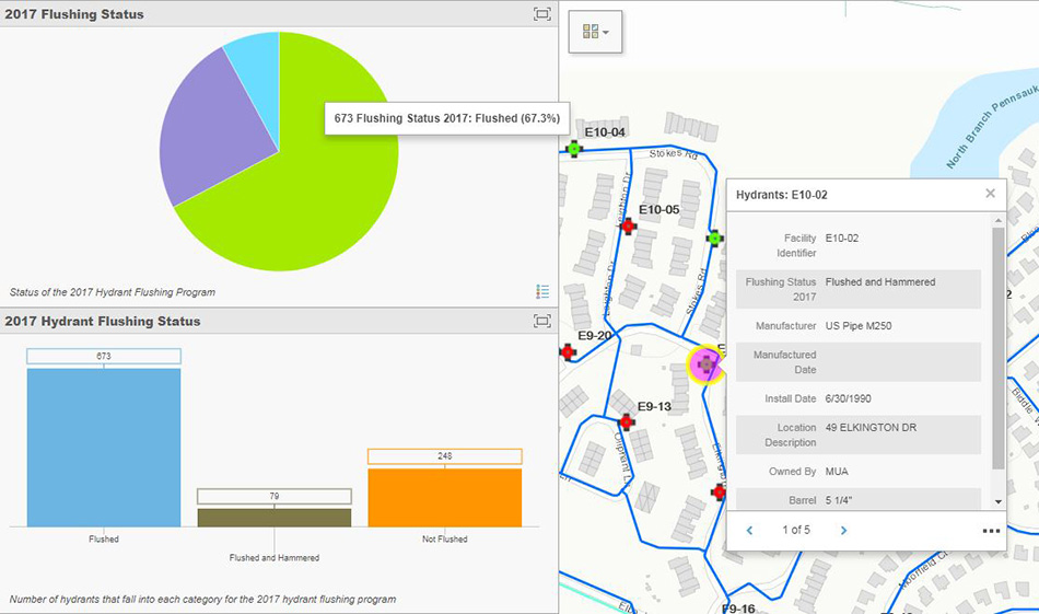
On-Call GIS Services
Client | Mount Laurel Township Municipal Utilities Authority, NJ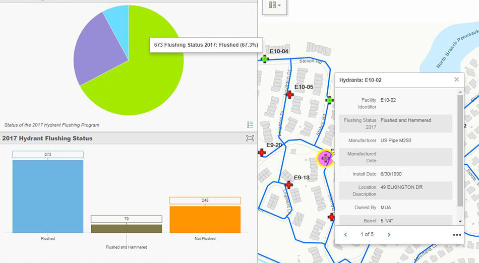
Performed a GIS Needs Assessment to identify and address gaps between the current use of GIS and the desired use of GIS at the Mount Laurel Township Municipal Utilities Authority. The Needs Assessment included a review of existing hardware, software, data, people, and business processes. A GIS Implementation Plan was prepared and is being implemented.
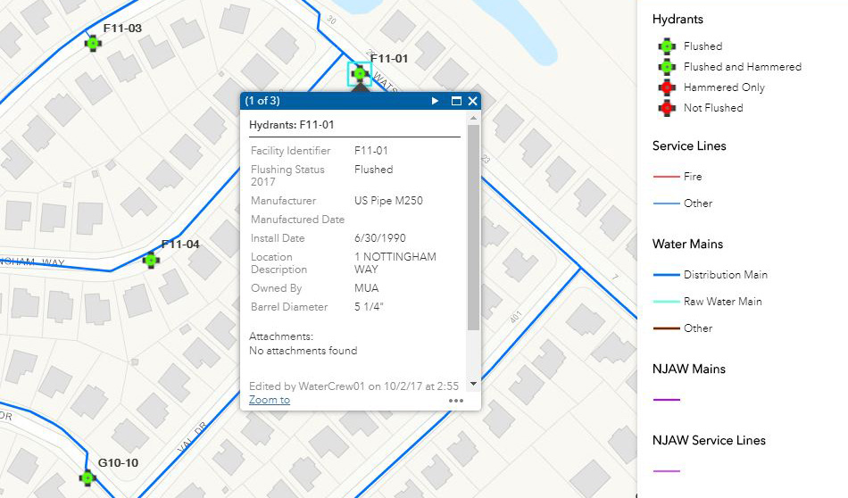
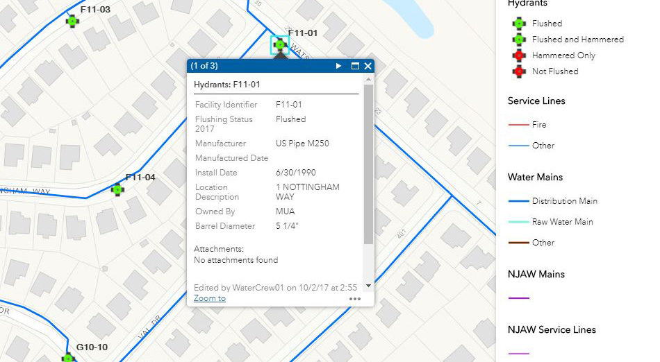
As part of the GIS Implementation Plan, our team has configured ArcGIS Server and implemented a web GIS which includes web maps of the water distribution, sanitary sewer, and stormwater systems. The web GIS has been extended to the field staff through the Esri Collector for ArcGIS application, which allows field staff to view and/or edit the GIS in real time. A dashboard view, which allows office staff to view field operations in real time, was configured using Esri’s Operations Dashboard for ArcGIS. Our team has also implemented the use of centimeter grade, real time GPS equipment. The Eos Arrow Gold equipment was selected due to integration with Esri’s applications. The Arrow Gold has been configured to access a virtual reference station (VRS) which allows for real time, centimeter grade data collection.
SERVICES
- GIS