
How Well Do You Understand Your Property?
Whether you’re a Landowner or a developer looking to make changes to your property, it’s likely you will need an ALTA/NSPS Land Title Survey prior to getting started. Or perhaps you are an owner seeking to sell their business or begin a new site development. Regardless of your goals, there are important things to consider before moving forward. As with most transactions, you want to be sure the thing you are buying or selling is in excellent condition. This means evaluating the item for any visible damage or imperfections that may hinder the sale from happening. The same concept applies to construction projects. Everything on the property has its own designated location. Things are placed strategically so that they don’t create obstructions, run onto neighboring properties or cause legal issues before building, even when working with a vacant site.
That’s why obtaining an ALTA/NSPS Land Title Survey is critical to getting an overview of everything located on the property. From pinpointing areas that may have changed over time to evaluating whether the fence you recently installed sits just within your property’s boundary lines, it’s imperative that you stay up to date on regular surveys, and updates regarding the ALTA/NSPS standards before performing work to ensure you are taking the correct approach. Ultimately, it all depends on what you are doing and what your goals are, however, one of the very first steps to ensuring your project is on the pathway to success is by staying informed.
Looking for information regarding the 2026 updates? Click here to read more.
What is an ALTA/NSPS Land Title Survey?
An ALTA/NSPS Land Title Survey helps individuals gain a better understanding of what is currently on a site. ALTA land surveys are performed by licensed professional land surveyors who are certified and bring seasoned experience to different types of projects.
Typically, the lender, title company, or buyer chooses what they want to have included from the Table A Checklist depending on their needs and scope of the project. Any additional items selected by the client can be negotiated with the surveyor. Should any changes be added, they must be explained under Item 21.
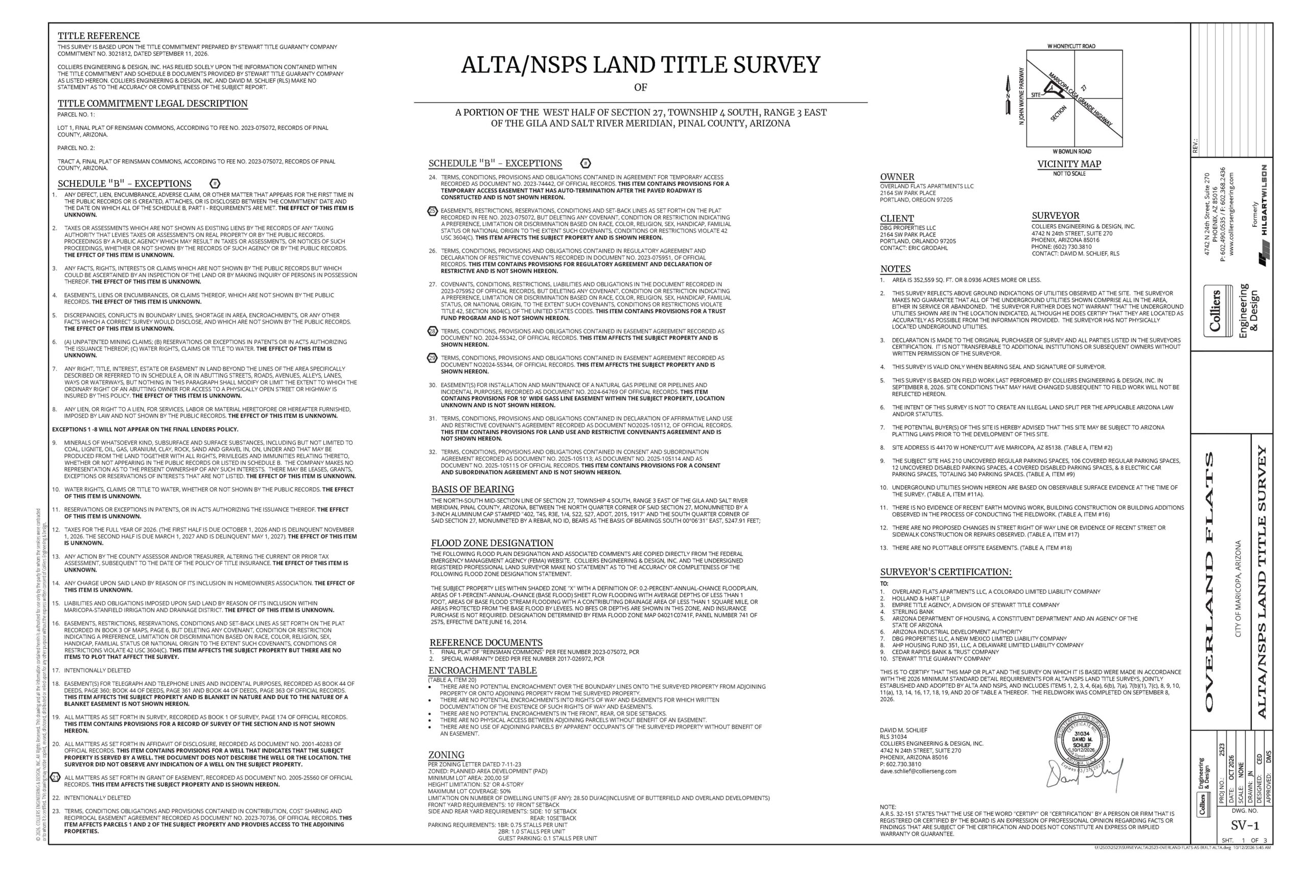
Opposed to a traditional boundary survey, ALTA Surveys are comprehensive, bringing fieldwork, records research, legal interpretation, and mapping together to create a single clear representation of a property. As noted by Dave Schlief, Department Manager of Survey/Geospatial, ALTA surveys help set the basis for development, allowing surveyors to complete land divisions, create legal descriptions, and exhibits of the designated property. This holistic approach provides a bird’s eye view of everything including site improvements, utilities, potential easements and encroachments, preventing what could generate long-term issues, right from the very start.
Why Do You Need an ALTA/NSPS Land Title Survey?
To alleviate potential conflicts, confusion, and encroachments, ALTA surveys are critical and an essential step to making sure your property is insured. Prior to any project, lending institutions require the client to have an ALTA survey done before they lend any funds.
How Long is an ALTA Survey Good for?
Although there is no specific expiration date for an ALTA survey, it is important to update it frequently depending on the property type or location to ensure it accurately reflects what is currently there. Factors can include the size, complexity of the boundary and vacant versus fully developed sites. However, there are instances where lenders, attorneys and title companies require one such as when site conditions change.
For example, if you’ve built or added something new onto your property such as a fence or detached garage, a new survey is required to ensure they are situated within the boundaries of your home to alleviate potential encroachments. It is recommended however, that Landowners update every 3-5 years before any sale or refinance to stay on the safe side.
Be Proactive.
When it comes to determining whether you need an ALTA/NSPS survey or not, it depends heavily on your project needs, if you’ve made changes that extend beyond your property line, if you’re planning on selling/leasing or if you’re undergoing construction or development. Regardless of what it may be, it is important to consult with a professional beforehand to make sure you are making informed decisions that ensure seamless site development decisions.
Effective as of February 23, 2026, the American Land Title Association (ALTA) and National Society of Professional Surveyors (NSPS) made important changes directly affecting land surveyors, title companies, lenders, buyers, sellers and individuals insuring property nationwide. Of the 20 items listed in Table A, a document outlining optional survey responsibilities and specifications, the following sections below focus on two primary updates including the requirements specified in item 15 and item 20.
Two of the main key changes include records research, indicating the level of detail the surveyor must provide related to collected imagery in item 15, in addition to how potential encroachments are actively being more clearly defined that relative positional precision addresses in relation to item 20 in the Table A checklist.
Table A: Item Number 15
Features, other than the boundary survey portion of an ALTA/NSPS Land Title Survey and the location of features in close proximity to a boundary or other title or relevant setback line, may be shown using imagery; however, the surveyor must:
(a) agree with the client in writing on imagery to utilize, including source, date and/or version of imagery, and licensing costs and requirements,
(b) discuss the ramifications of such practices (e.g., the potential accuracy, precision and completeness of the imagery gathered thereby) with the insurer, lender, and client prior to the performance of the survey, and
(c) place a note on the face of the survey explaining the source, date, precision, and other relevant qualifications of any such imagery.
What this means:
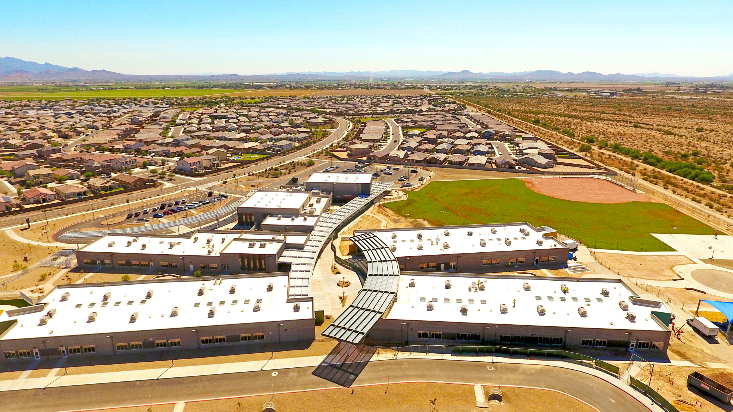
Should a client request to include item 15 as one of their project requirements, the surveyor and client must have a mutual agreement and understanding regarding the basis of the imagery being used and costs involved. For example, should the project require a quicker turnaround time or possess a need for above ground improvements, the use of a drone or unmanned aerial system (UAS) to survey the property can be a great option to provide the client with a comprehensive view of the land. At this point, the land surveyor must provide detailed information regarding the drone flight, how the system was controlled and what equipment was used during that time. By providing the client with this information, they can feel validated during their decision-making process having knowledge of the steps that were taken to achieve the desired results.
The job of the land surveyor is to make sure that the client has complete access to this information, making sure they’re fully transparent of potential ramifications and trade-offs should they choose one image source over another.
Table A: Item Number 20
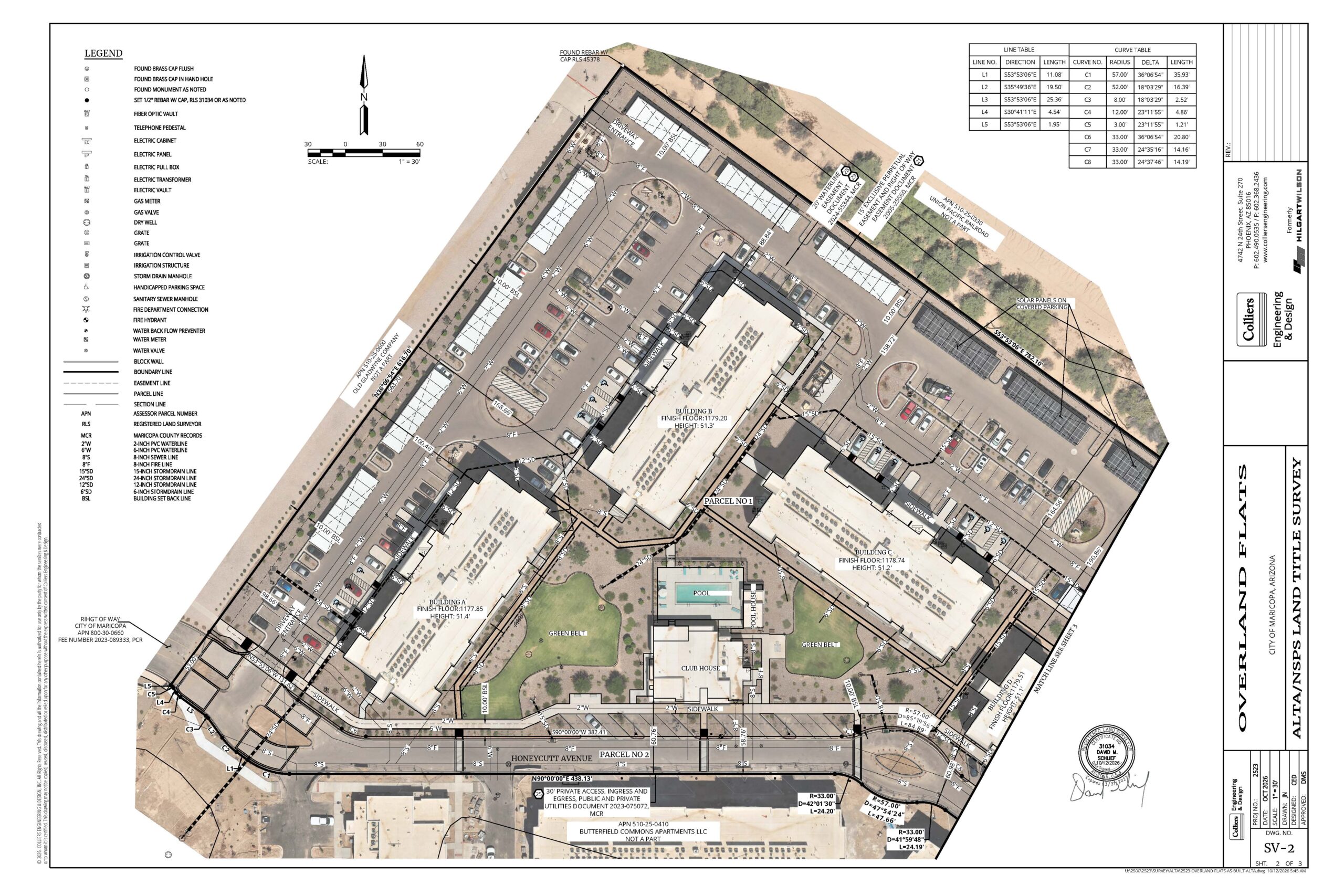
When observed in the process of conducting the fieldwork or otherwise identified in the process of preparing the survey the following conditions and potential encroachments must be summarized in a table and indicated on the face of the plat or map. Without expressing a statement of legal opinion or an opinion as to ownership, the table must identify the physical conditions and provide a means by which the conditions can be readily located on the face of the plat or map by a reviewer; however, this table may not be a comprehensive list of all concerns shown on the plat or map of the survey.
• Potential encroachments over boundary lines onto the surveyed property from adjoining property and onto adjoining property from the surveyed property.
• Potential encroachments into rights of way and easements for which written documentation of the existence of such rights of way and easements was provided to or obtained by the surveyor pursuant to Section 4.
• Potential encroachments of front, side or rear setbacks, but only when the setback requirements specific to the surveyed property were provided to the surveyor pursuant to Table A item 6(a) or 6(b) or provided in recorded documents.
• Physical access between adjoining parcels without benefit of an easement for which written documentation of the existence of such easement was provided to or obtained by the surveyor pursuant to Section 4.
• Use of adjoining parcels by apparent occupants of the surveyed property without benefit of an easement for which written documentation of the existence of such easement was provided to or obtained by the surveyor pursuant to Section 4.
What this means:
Should a client request to include item 20 as one of their project requirements, they now have a clearer understanding of possible encroachments at stake. Whether that’s over property lines, under buildings or potential encroachments into different types of easements, the land surveyor must provide a detailed description on the face of a plat or map to help the client easily identify physical conditions and help them better understand what they’re working with moving forward.
For a comprehensive overview of all Minimum Standard Detail Requirements For ALTA/NSPS Land Title Surveys, refer to the 2026 ALTA/NSPS Table A checklist.
Your Roadmap to Success
ALTA/NSPS Land Title Surveys include everything you need to know prior to starting your project including basis of bearing, legal descriptions, flood zone designation, and zoning information. Without it, you risk potential issues including unnecessary delays, costly mistakes and eroding trust between you and your client.
“ALTA is a national standard. It doesn’t matter if you’re surveying in New York, Florida, Arizona, or California. The requirements on an ALTA is consistent for all of us and all surveyors work by the same playbook.”
– Dave Schlief, Department Manager, Survey/Geospatial
Partner with Us at Colliers Engineering & Design
Think your next site development might require an ALTA/NSPS survey? Wondering which items apply best? Connect with an expert at Colliers Engineering & Design to get advanced guidance you can trust from a professional who thoroughly understands your goals, needs, and the full scope behind your property.
Have additional questions regarding this topic? Contact Dave Schlief, Department Manager of Survey/Geospatial for more helpful insights.