Hydrographic
Hydrographic and bathymetric surveying that supports safe, resilient marine infrastructure
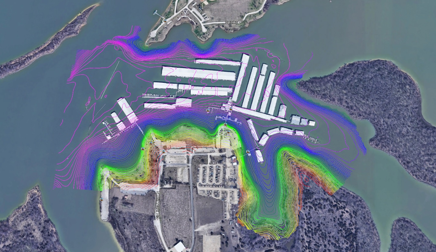
Accurate underwater data is critical to marine construction, dredging, shoreline stabilization, and coastal infrastructure projects. At Colliers Engineering & Design, our hydrographic professionals deliver high-resolution bathymetric and subsurface mapping that supports design, navigation safety, and long-term coastal resilience.
We work across public agencies, port authorities, energy providers, and private development projects to provide reliable marine data that informs permitting, engineering, and construction decisions.
- Hydrographic and bathymetric surveys
- Multi-beam and single-beam sonar mapping
- Side-scan sonar and magnetometer surveys
- Dredge support and volume calculations
- Submerged utility and depth-of-cover mapping
- Post-storm condition and hazard surveys
- Coastal and port design surveys
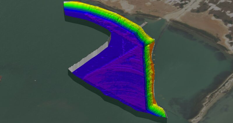
- 3D underwater terrain modeling
Our approach
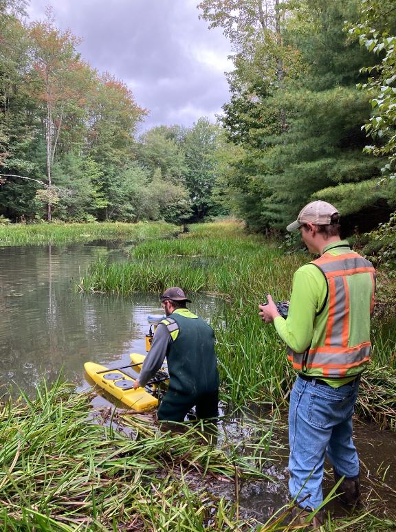
Hydrographic surveying demands technical precision and environmental awareness. We tailor each data collection strategy to site-specific conditions using manned vessels, remote platforms, and advanced sonar technologies to ensure accuracy, safety, and efficiency.
Our hydrographic teams coordinate closely with surveyors, engineers, and coastal specialists to integrate underwater data with terrestrial mapping, GIS platforms, and infrastructure design models. This multidisciplinary collaboration strengthens project alignment from feasibility through construction.
SERVICES
- Land survey and measurement
- Mobile LiDAR mapping
- Unmanned aerial systems (UAS)
- Subsurface utility engineering
- GIS asset management
- Environmental and coastal permitting support
Designing for safety, resilience, and performance
Marine and coastal projects must account for changing conditions, sediment movement, and long-term environmental impact. We deliver hydrographic data that supports resilient shoreline design, accurate dredging volumes, and safe navigation clearances.
From ports and ship channels to waterfront developments and energy corridors, our solutions provide dependable subsurface insight that reduces uncertainty and strengthens long-term performance.
Coordinated marine surveying for complex environments
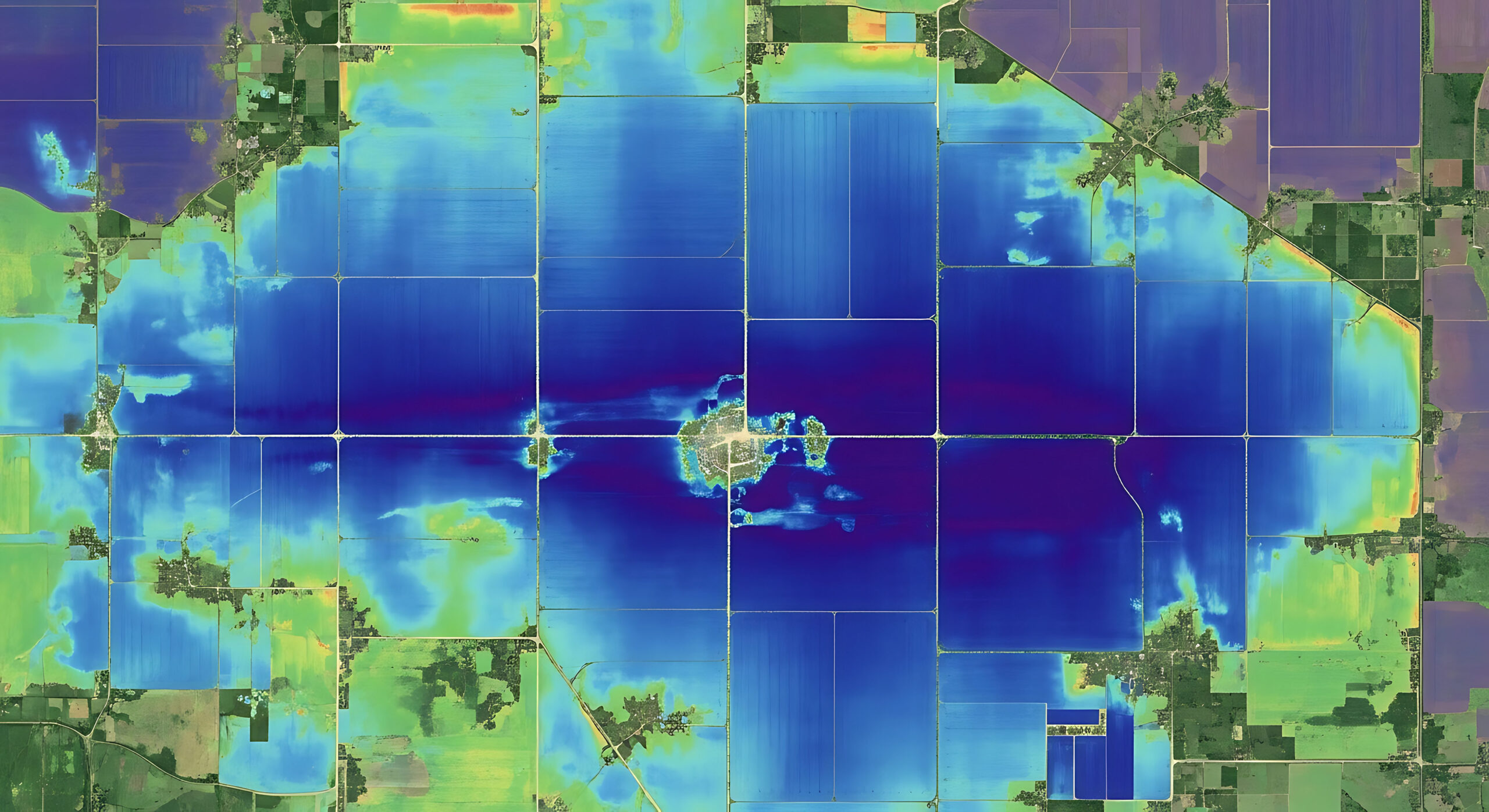
Hydrographic surveying is most effective when integrated with broader engineering and geospatial systems. At Colliers Engineering & Design, our teams align bathymetric data with land surveys, LiDAR models, and utility mapping to create comprehensive project datasets.
This coordinated approach improves communication between marine engineers, civil designers, and regulatory agencies, helping clients move forward with clarity and confidence.
Frequently asked questions
A hydrographic survey measures and maps underwater terrain, water depths, and submerged features using sonar and positioning systems. It supports dredging, marine construction, shoreline restoration, and navigation safety.
Bathymetric surveying focuses specifically on mapping underwater depth and terrain, while hydrographic surveying includes additional data collection related to hazards, utilities, sediment conditions, and navigational features.
Hydrographic surveys are typically required for dredging projects, port and marina development, bridge and waterfront construction, submerged utility installation, and post-storm assessments.
Accuracy depends on equipment selection and survey methodology. Multi-beam and single-beam sonar systems, combined with precise GPS positioning and quality control procedures, allow for highly accurate depth and terrain modeling.
Let’s talk about your next project!
Our multidisciplinary approach to design, combined with a deep understanding of the industry and passion for innovation, has positioned us as leaders consistently delivering outstanding results in shaping the built environment.