Utility Design Engineering

How our utility engineers help clients plan, locate, and build the infrastructure that keeps communities connected
Every utility project starts with the same challenge: understanding what already exists below ground and building confidently around it. Whether the work involves routing new fiber networks, designing pipeline corridors, or mapping existing underground utilities before a single shovel breaks ground, the quality of the engineering and the accuracy of the data define whether a project moves forward smoothly or runs into costly conflicts.
Our utility design engineering team provides a full line of integrated services that span the entire project lifecycle: right-of-way acquisition, deed and title research, environmental permitting, civil engineering, subsurface utility investigation, and civil survey services. That range of capability, delivered under one roof, gives clients a turnkey partner for utility infrastructure projects of any scale, from a single corridor to a multi-state deployment.
- 3D Utility Modeling
- Cable/Fiber/Phone Locating
- Civil Engineering
- Comprehensive Data Management
- Concrete Evaluations & Reinforcement/Conduit Mapping
- Electric & Gas Line Locating
- Environmental Permitting
- Excavation/Drilling Clearances
- Fiber Network Design
- Georeferenced Mapping & GIS Utility Information
- Hydrographic/Bathymetric Surveys
- Integrated Survey Deliverables with Existing Utilities
- Nondestructive Excavation
- Right-of-Way Acquisition & Land Management
- Risk Envelope for Utilities
- Subsurface Utility Engineering (SUE)
- Survey & Geospatial Services
Our approach
Utility projects are inherently multi-disciplinary. They cross property boundaries, intersect with existing infrastructure, and move through regulatory environments that vary from one jurisdiction to the next. Our team is built to handle that complexity. We bring civil engineers, licensed surveyors, environmental specialists, SUE professionals, and right-of-way agents together from the start of an engagement so that design, permitting, land management, and field investigation stay coordinated throughout. The result is fewer surprises, tighter timelines, and infrastructure that is designed with a complete understanding of what is already in the ground and what it takes to build around it.
As a leader in geospatial and land surveying, our survey professionals bring the most advanced methods available to utility and energy projects, including topographic and boundary surveys, pipeline and utility ROW surveying and staking, UAS and aerial photo control, remote sensing, 3D high-definition laser scanning, and mobile LiDAR. That survey capability feeds directly into our engineering and SUE work, giving every project a foundation of accurate, reliable spatial data.
Knowing what is underground before you build
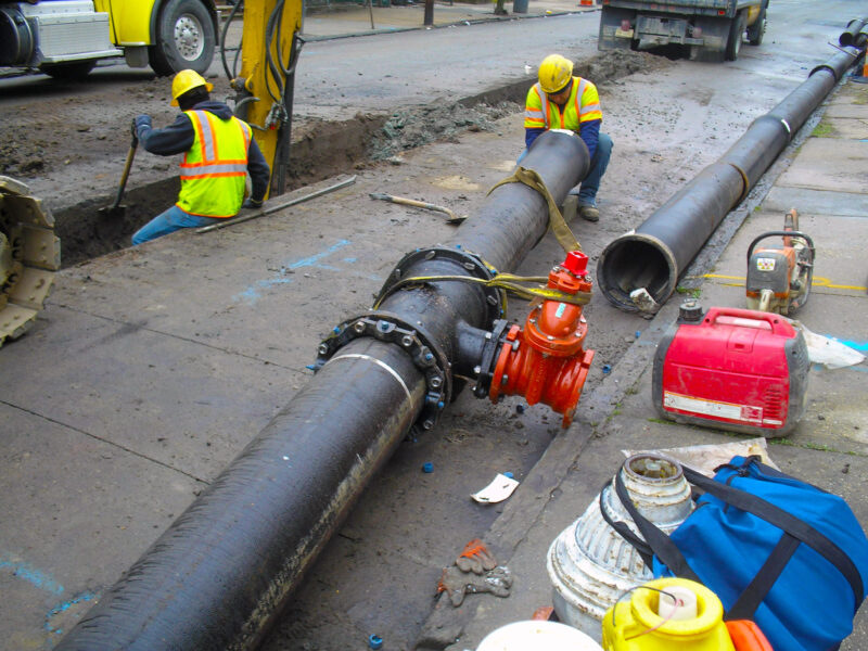
Utility conflicts are among the most common and costly causes of construction delays. Our subsurface utility engineering professionals reduce that risk by accurately identifying, verifying, and mapping underground utilities before design and construction begin. We follow the ASCE 38 Standard Guidelines for Investigating and Documenting Existing Utilities, integrating geophysical utility designation using electromagnetic techniques and ground penetrating radar, nondestructive excavation methods such as vacuum excavation to expose utilities without damage, and detailed survey using robotic total stations, GPS, and LiDAR to document locations precisely. That data flows into 3D utility models, georeferenced mapping, and integrated survey deliverables that give designers and contractors the clearest possible picture of subsurface conditions. Our SUE services support a wide range of clients, including departments of transportation, airports, railroads, transit authorities, land developers, government agencies, utility owners, and private sector clients.
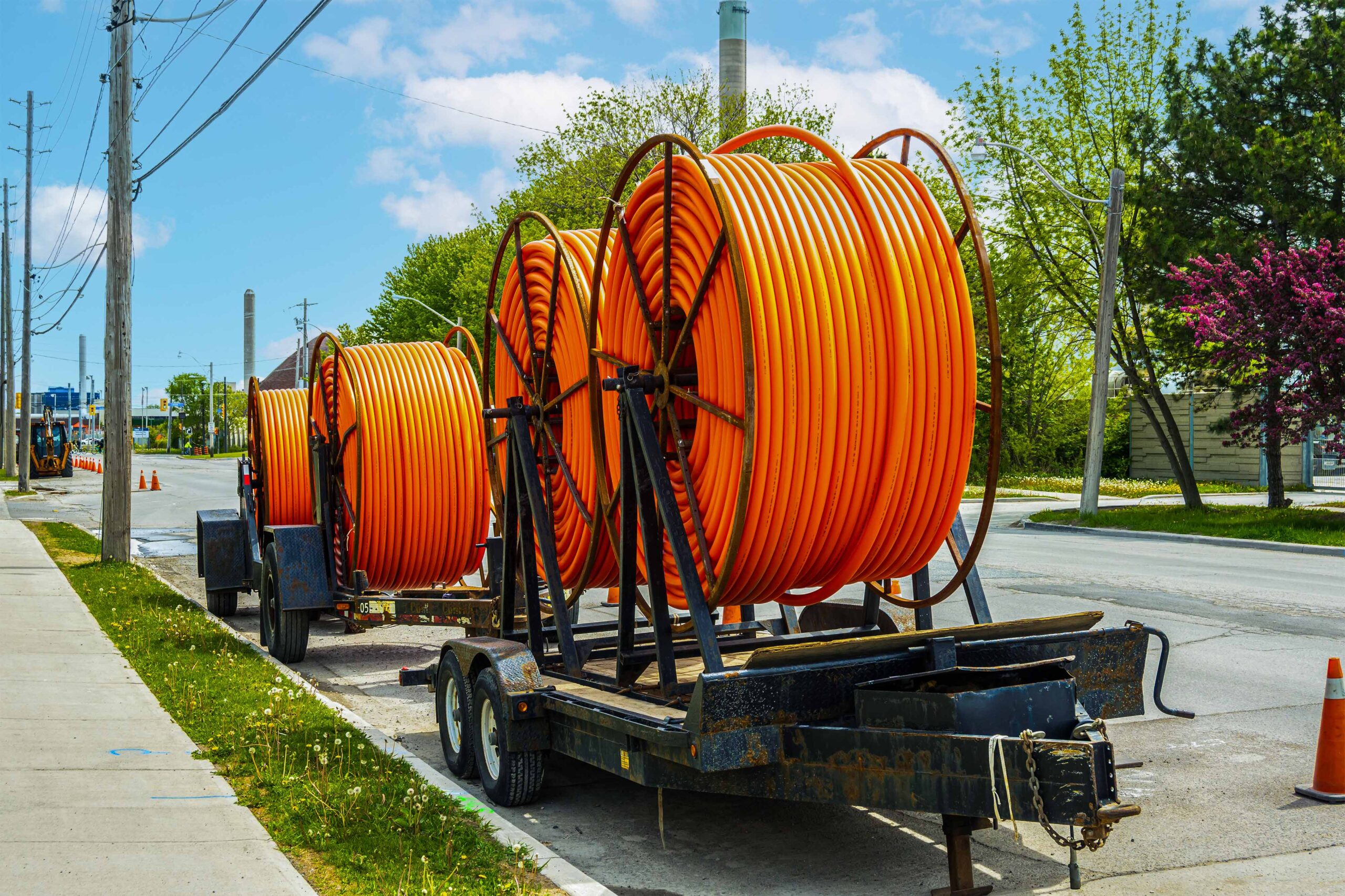
Fiber, pipeline, and utility corridor design
Deploying new utility infrastructure, whether fiber optic networks, gas and electric lines, or pipeline corridors, requires the same integrated approach we bring to subsurface investigation. Our civil engineers and survey professionals handle route design, ROW surveying and staking, and the permitting and land acquisition work that clears the path for construction. For fiber projects in particular, the speed of deployment matters as much as the accuracy of the design, and our team is structured to deliver both. We manage the full scope of land management services, from deed and title ownership research and right-of-way acquisition through environmental permitting and construction support, so that clients have a single point of accountability from planning through buildout.
Let’s talk about your next project!
Our multidisciplinary approach to design, combined with a deep understanding of the industry and passion for innovation, has positioned us as leaders consistently delivering outstanding results in shaping the built environment.