
Coming A Long Way
Driven by rapid technological advancements in the transportation sector, traditional survey practices have evolved far beyond past industry standards. As the demand for safer and faster travel increases, so have the expectations in ensuring highly reliable, functional railroad systems. Today, rail corridors are continuously planned, mapped and actively maintained using modern techniques and the latest technologies to maximize passenger safety, operational efficiency and infrastructure longevity nationwide.
Early Railroad Surveying
It is no coincidence that the development of the steam engine and the population growth of the east coast in the early 1800s fueled the great migration westward. By the 1850s efforts were underway to explore and map various transcontinental routes to the west coast. Competition over the location was often heated, but little could compare to the terrain of the Rocky Mountain and Sierra Nevada ranges and inclement weather conditions.
To overcome these obstacles, surveyors relied on emerging tools like the transit and the hundred-foot chain, which increased the accuracy of the measurements and lightened the load of equipment hauled across the wilderness.
Despite the severe weather and geographic roadblocks, the eventual development of multiple transcontinental rail lines came about, providing alternative routing, lowering costs, opening new markets and laying the groundwork for modern survey standards.
Determining the Best Surveying Technique
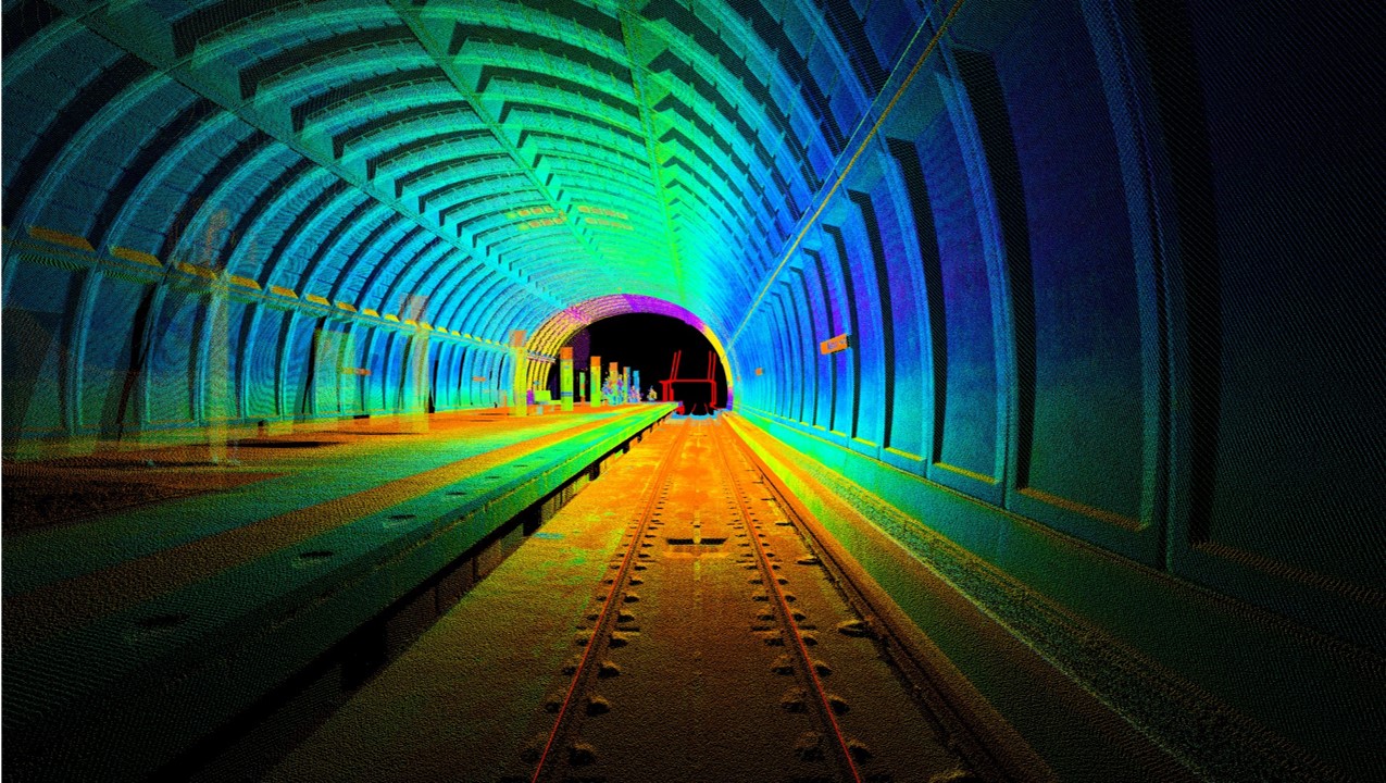
Jumping forward to today, the surveying industry has evolved to meet the project needs of rail authorities and contractors, while the application of specialized equipment is used to capture track conditions in real time, permitting engineers to analyze data and make immediate decisions affecting rail safety. From surveys conducted to review and correct track alignment to full-scale 3D modeling of subway tunnels and station platforms, rail mounted measuring devices, laser scanners and technology all play an important role.
By having early discussions on data requirements and how that data will be applied, teams can select the right surveying technology to meet project deliverables, enhancing safety, streamlining schedules and reducing costs.
Is your surveying technique providing you with the results you need?
Conventional Surveys
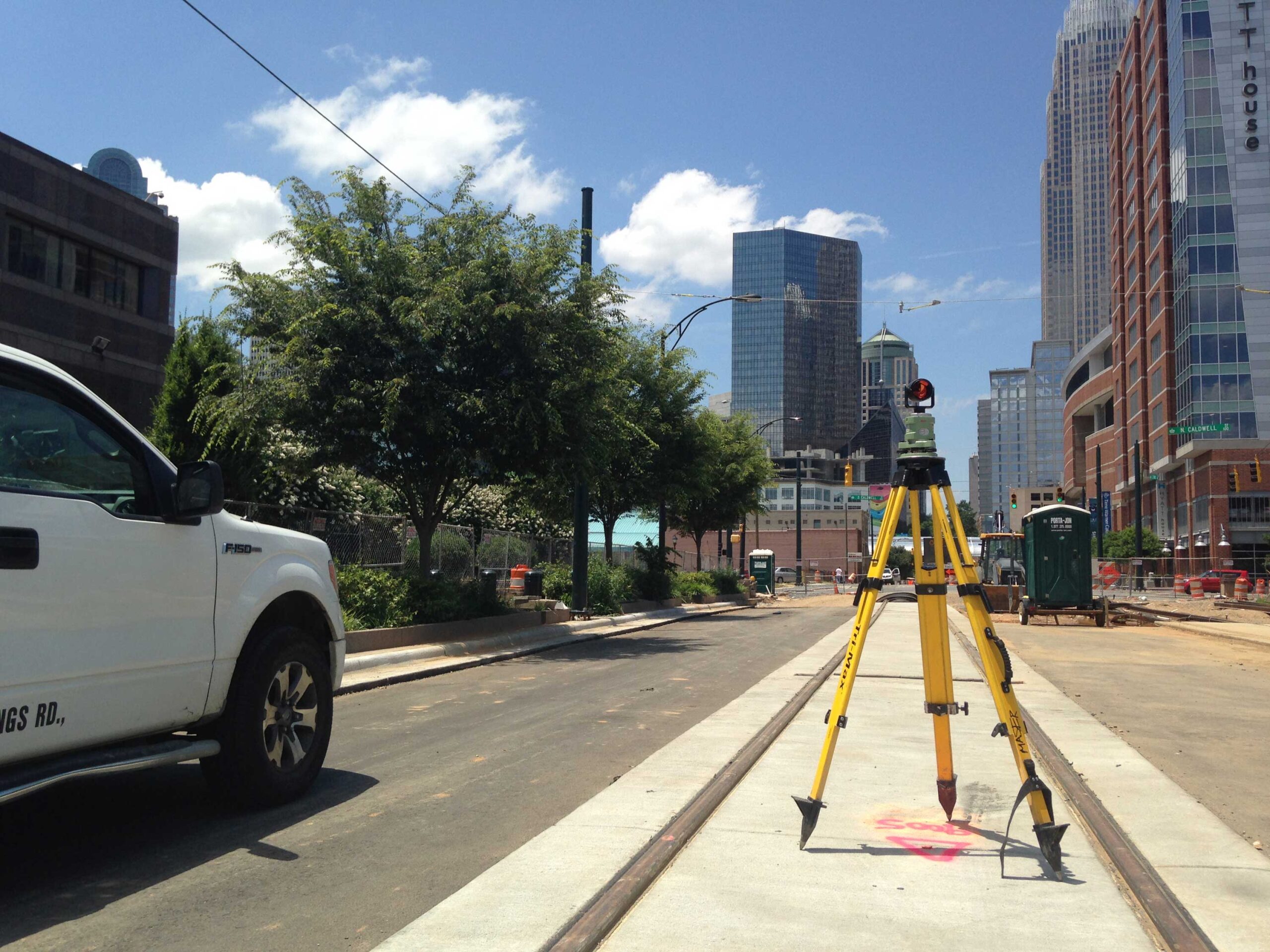
The most basic of surveying methodologies may be the best solution and provide cost effectiveness for the tasks at hand. Surveyors can establish project control points, locate individual tracks and wayside features often as a one-man crew utilizing a total station and prism rod. Many owners favor this approach as it minimizes the survey crew size and the number of watchman / lookouts required to ensure jobsite safety. Field measurements are taken and stored on a rod-mounted computer, then transferred to the office for processing and development of maps and engineering plans. Conventional surveys are required when accurate measurements of railheads and other features must be provided for track engineering and design.
Static LiDAR Surveys
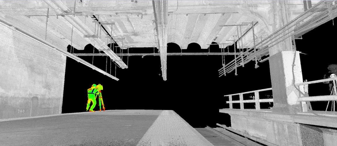
A Static LiDAR survey utilizes a tripod-mounted 3D hi-definition laser scanner to measure physical features by emitting an eye safe laser beam and recording the time it takes the beam to return to the instrument. The scanner is set up at strategic locations offering good visualization of the project site and is capable of quickly collecting millions of data points and color imagery for the development of a 3D point cloud. It is a preferred method of data collection at locations with lots of train movements or difficult to access features like bridge abutments. It can be used to safely scan station platforms, stairwells, substations, maintenance shops, overhead utilities and wayside objects. The 3D point cloud can be processed into plan and profile site drawings, digital terrain models (DTMs), and Building Information Modeling (BIM).
Corridor Surveys
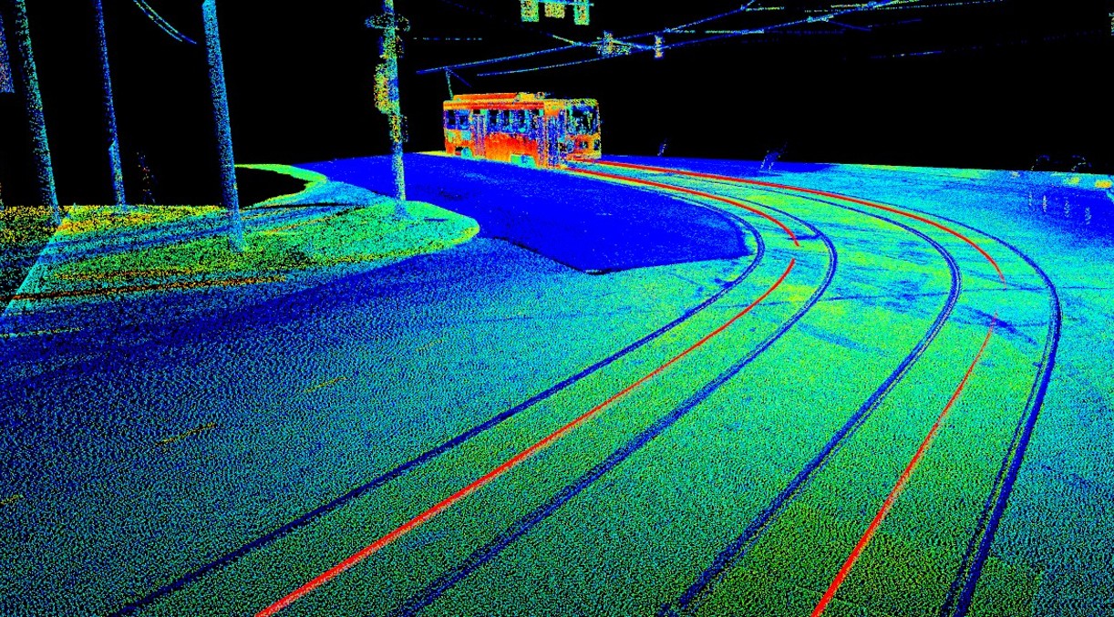
To collect track and wayside features over long distances, a mobile LiDAR system can be mounted to a hi-rail vehicle or revenue train and used to record field data while traveling at authorized speed. In an urban environment, streetcar or trolley systems collect data utilizing a standard rubber tire vehicle traveling in adjacent roadway lanes. Like static scanning methods, 3D point clouds can be created to depict rails, overhead catenary systems and utilities, traffic lights, bridges and other features for development into topographic maps and DTMs.
The accuracy for mobile LiDAR is approximately 0.04-feet horizontally and vertically when utilizing wayside survey control points to register and position the cloud data. In locations where accurate survey data is required, conventional methods can be used to supplement the point cloud to provide design quality data.
Wayside Clearance and As-Built Surveys
Utilizing specialized equipment, the clearances between wayside features and the dynamic envelope of a rail mounted vehicle can be measured and depicted in deliverable profiles. A fixed position LiDAR scanner is mounted to a rail-based pushcart and millions of profile cuts are measured as the system operator walks down the track. Within the software, client specific clearance envelopes or plates can be created and modeled to represent dynamic movements through tangents or curves at superelevated conditions. The distance between the generated envelope and wayside features can be automatically calculated and depicted in profile views at stationing increments or at a specific station.
Additionally, this cart system can also be utilized to measure as-built track conditions for comparison and reporting of deviations in construction to the design alignment and profile. Track measurements can be made continuously or at owner specified intervals and deviations are reported by alignment stationing with out of specification locations highlighted for additional review or correction.
Unmanned Aircraft Systems (UAS) Surveys
The rapid development and widespread use of aerial platforms have also entered today’s surveying toolbox. Aerial platforms can weigh from a few pounds up to fifty-five pounds and be equipped with a multitude of sensors to include LiDAR scanners, color, infrared and video cameras. Some of the larger platforms can be outfitted with magnetic sensors and used to detect and map unexploded ordinance (UXO) locations, thus keeping ground-based personnel safely out of harm’s way.
Utilizing an Unmanned Aerial System (UAS) for surveying railroads provides a level of safety to field crews that’s unachievable by personnel on the ground. UAS can also be used to assist in determining vegetation control measures, assist in grade crossing inventories, help in storm recovery efforts or post derailment condition assessment and mapping.
Subgrade Condition and Utility Location Surveys
Ground Penetrating Radar (GPR) systems utilize radio waves to detect underground anomalies such as structures, voids and utility lines. When utilized alongside the railroad, communication and signaling cables can be detected, and utility lines crossing or parallel to the tracks can be located prior to excavation therefore reducing the risk of service interruptions. GPR can also be used to identify the location of potentially fouled ballast and identify subsurface anomalies that could negatively affect the stability of the subbase and ride quality.
Identifying the Best Survey Application for Your Project
Railroads transverse six of the world’s continents through every imaginable environmental condition. Whether vast plains or mountains, crossing rivers or deserts, they move people and freight daily. To maintain or improve service offerings, railroads require inspections and upkeep to operate safely. Additional tracks, yard improvements or the transportation of large loads all require some aspects of surveying services.
To determine the surveying methodology best suited for your project, it is important to identify the needs and characteristics of the site during the initial scoping phase. By recognizing and conveying the limiting factors such as safe access, level of site details needed and intended usage of the survey data, an experienced rail surveyor can help you identify the safest and cost-effective solutions.
Questions? Contact Thomas Reed, Geographic Discipline Leader of Rail Services at Colliers Engineering & Design to learn which surveying technique fits best for your project.