Category: Survey
-
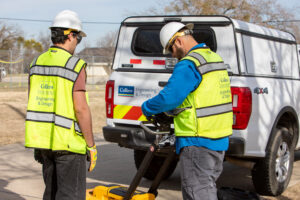
Reducing Risks, Saves Time and Money
Unknown underground utilities are the biggest risk on any construction project. Learn how pairing SUE and survey into one site visit helps engineers design smarter and avoid costly surprises.
-

Turning Complexity into Clarity
Meet Darryl Strickler, RPLS — a Senior Survey Specialist who brings a Physics background and over a decade of field-to-office experience to every project, turning complex surveying challenges into precise, actionable results.
-
Behind the Scenes: UAS Taking Flight
In this new blog series, I want to combine my love of writing with the learning opportunities I get in the field and give you a behind the scenes look at the work we do! For the first edition, I thought it would be fitting to dive into something that can be used on a…
-

Q&A with Aimara Diaz La Rosa, PSM, Geographic Discipline Leader, Survey/Geospatial
Aimara Diaz La Rosa, PSM discusses among other things some of the exciting new construction building projects she’s involved with in the Miami area.
-

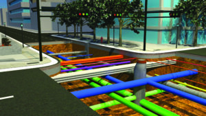
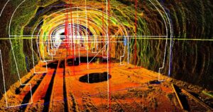
NavVis VLX Indoor Mobile Mapping System
The NavVis VLX indoor mobile mapping system (IMMS) enables us to scan and store every detail about a building simply by walking through the space.
-
It’s National 811 Call Before You Dig Day!
It’s August 11, or 8/11, and you know what that means… It’s National 811 Call Before You Dig Day! As a reminder to residents and excavators alike, calling 811 to locate your utilities before you dig underground is for your own safety! Having your utilities marked-out is a nationally free service and it is also…
-

Experts Choose Experts: Adaptive Reuse in NYC
New York City is home to 8.38 million people, according to the 2020 census. Since our country’s inception in the 1700s, NYC has been a center of commerce and culture. That being said, much of its infrastructure is over a century old. Packed tight with museums, restaurant, hotels, theaters, schools and of course, residences, NYC…
-

Women In Survey
Alice Cunningham Fletcher was an American ethnologist, anthropologist, and social scientist. She studied and documented Native American culture. Alice is also widely considered the first female surveyor and was regarded as effective and skilled. But women in survey were still very rare. In 1922, Irene Barclay was the first woman to qualify in England as…
-
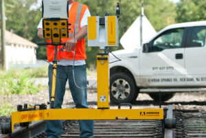
Next Level Railroad Track Optimizations
Learn how different survey methodologies, including Amberg, can collect precise track and corridor data to help with track optimization.
-
What Actually Is Survey?
Survey is more than just measuring boundaries and staking out construction sites. Join us as we ask, “What is survey?”
-
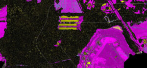
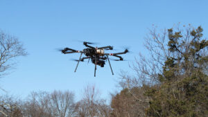
Using UAS for Pipeline Projects
Unmanned Aircraft Systems (UAS), or drones, can carry scanners that perform safe, cost-efficient, and fast LiDAR data collection. UAS LiDAR systems are particularly useful for scanning pipeline projects because of its unique features: small, unmanned, and maneuverable. This is especially true when comparing it to using aerial LiDAR performed by using a manned aircraft. First…
-
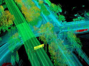
Mobile LiDAR Applications for Pavement Projects
Why Mobile LiDAR is Ideal for Mapping Pavement Projects Whether you are changing traffic flow at an intersection or working on a highway, pavement projects involving roadway corridors require engineers to understand the features and conditions they are working with. Using Mobile LiDAR for mapping long roadway corridors and associated features is ideal because it…