Union Township Stormwater Outfall Mapping
Union Township, NJ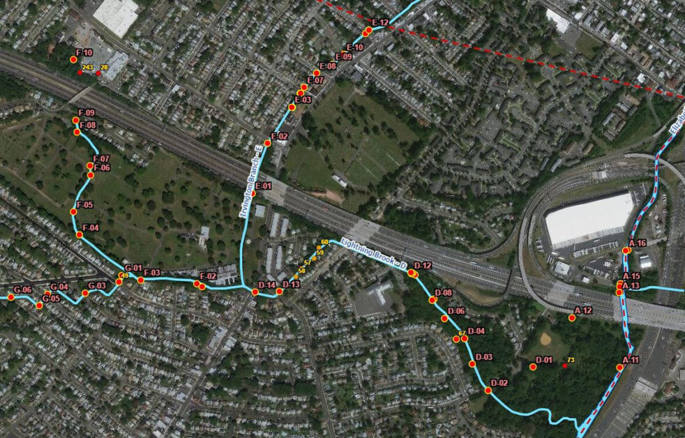
Union Township Stormwater Outfall Mapping
Union Township, NJ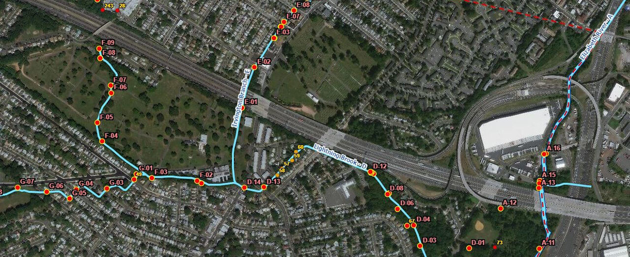
Our team provided Geographic Information Systems (GIS) and Global Navigation Satellite System (GNSS) services to Union Township to satisfy the New Jersey Department of Environmental Protection’s (NJDEP) Tier A Municipal Stormwater Permit requirements which requires stormwater outfall mapping, illicit discharge detection and elimination, and stream scouring remediation. The project consisted of locating 180 outfall structures along approximately 17 miles of waterways using centimeter-grade Eos Arrow GNSS receivers and Esri’s ArcGIS Collector and ArcGIS Workforce mobile applications.
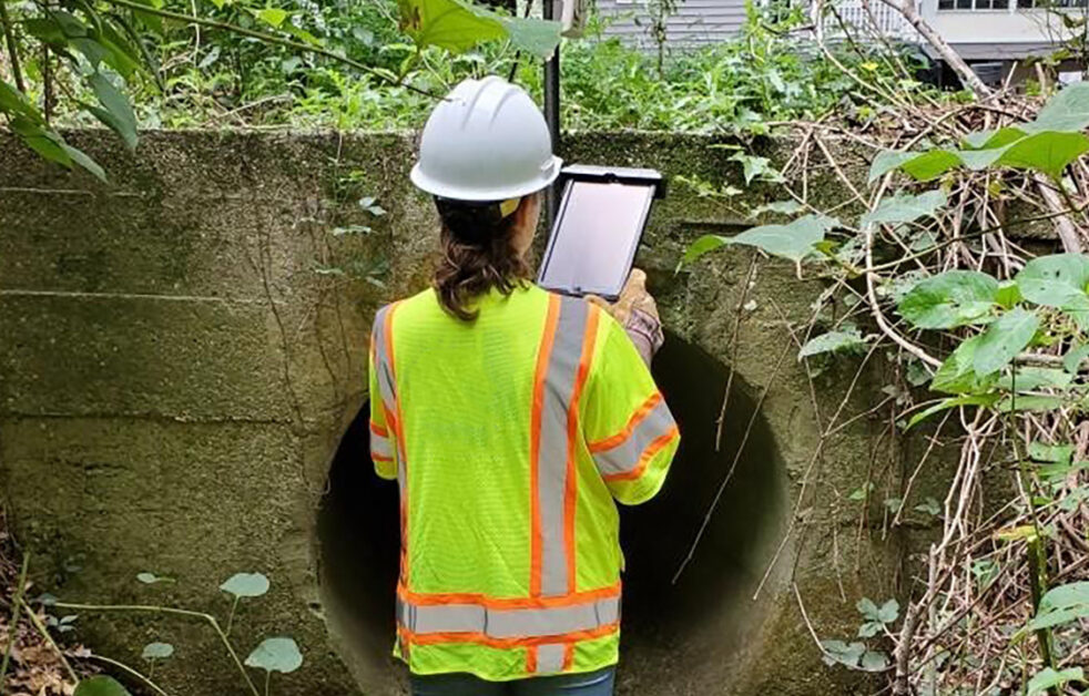
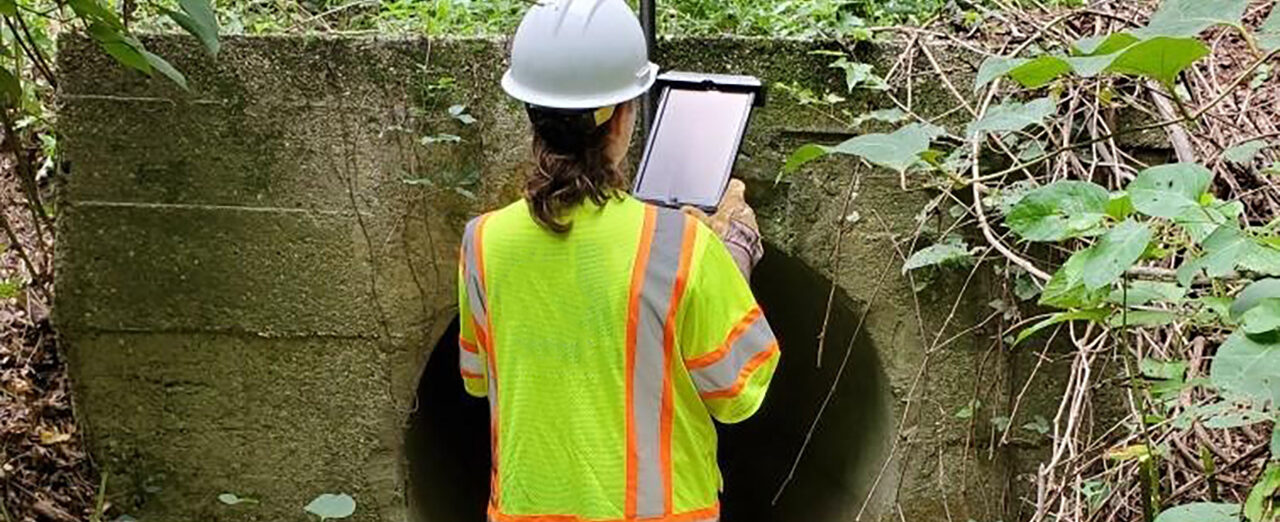
Field inspections were completed using the ArcGIS Survey123 mobile application to record outfall conditions, color, turbidity, and odor of discharge, the presence of dry-weather flow, damage to the outfall pipe, and photographs. Follow-up inspections were completed for any outfalls with flow during dry conditions and possible illicit discharge detected. Water samples were taken to distinguish between discharges that are contaminated by sanitary wastewater and other non-sanitary wastewater sources such as industrial wastewater or groundwater infiltration. Following the field data collection, our team prepared a stormwater outfall map and provided the inspection and water sampling reports and outfall photographs needed to update the Township’s Stormwater Pollution Prevention Plan (SPPP).
SERVICES
- GIS
- Governmental