LiDAR
High-definition LiDAR mapping that supports accurate, efficient infrastructure delivery
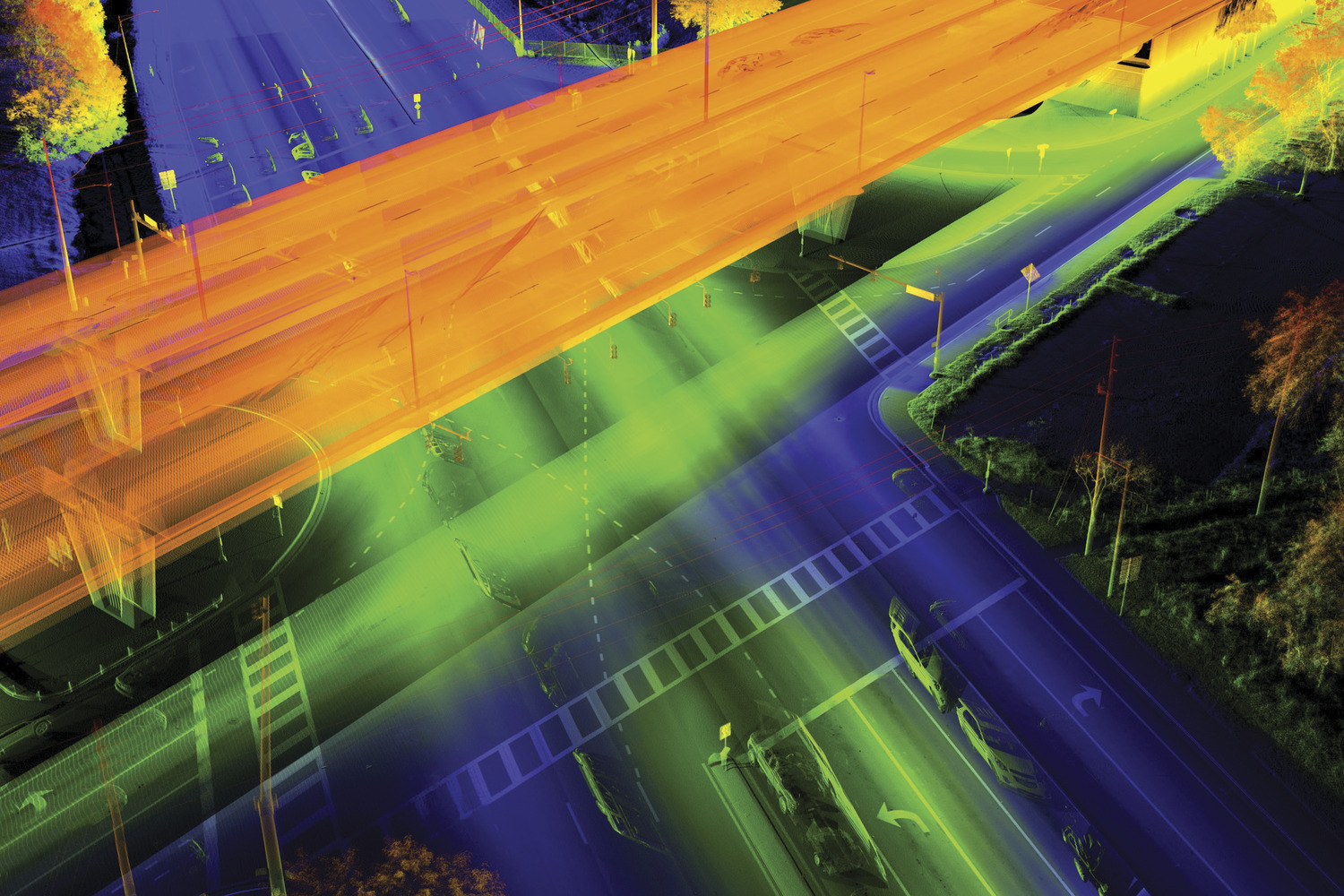
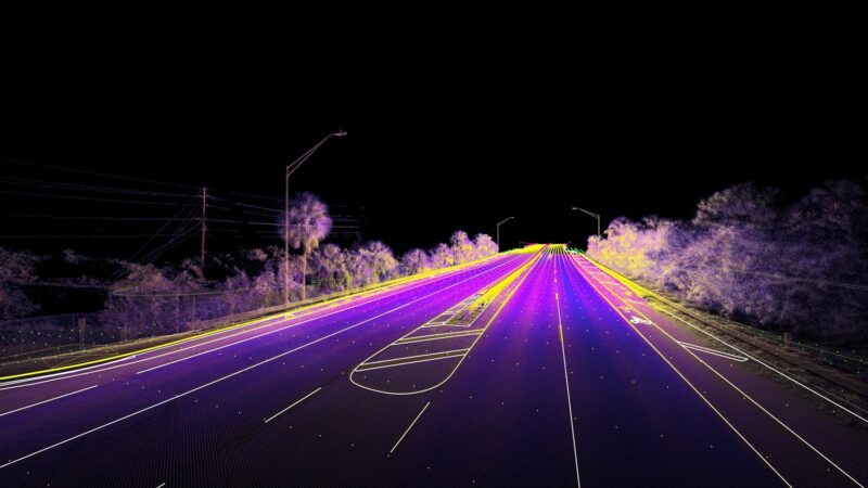
LiDAR technology enables rapid, high-density data collection across complex corridors and project environments. At Colliers Engineering & Design, our geospatial specialists deploy terrestrial, mobile, and aerial LiDAR systems to capture millions of data points with precision, supporting design, asset management, and construction planning.
We work across transportation, rail, utilities, infrastructure, energy, and development projects to deliver high-accuracy spatial models that reduce field time, improve safety, and strengthen design coordination.
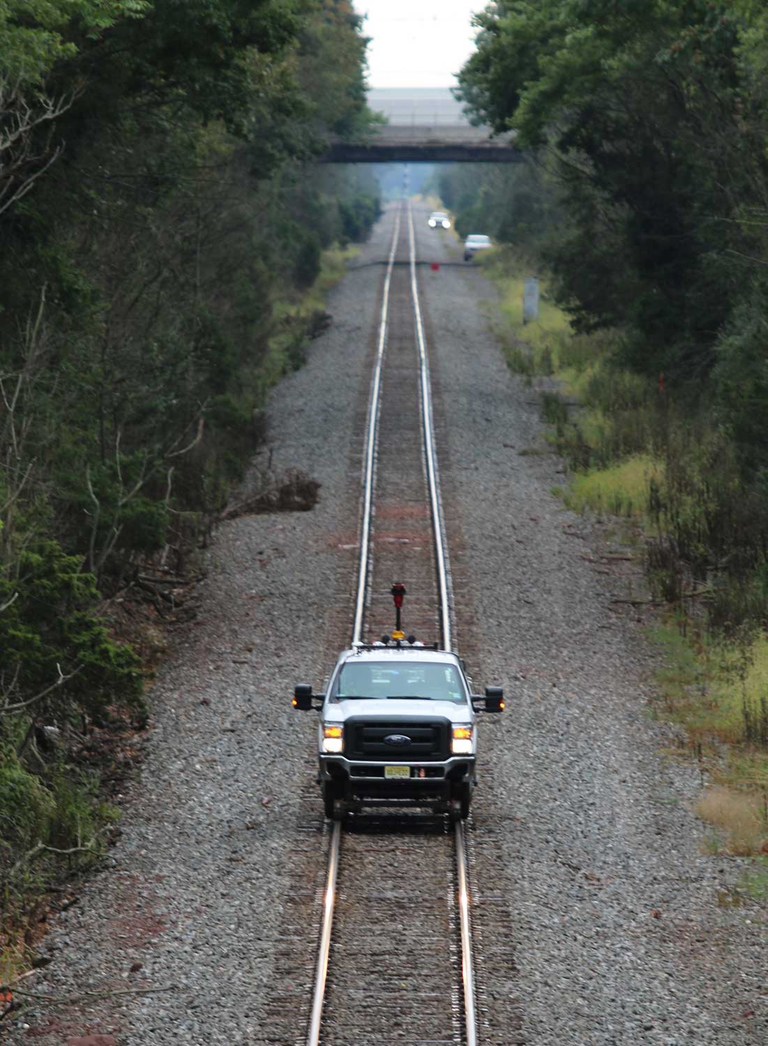
- Mobile LiDAR corridor mapping
- Terrestrial 3D laser scanning
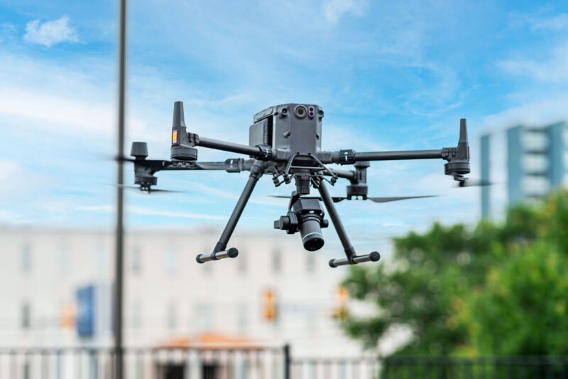
- Aerial LiDAR data acquisition
- Digital terrain model (DTM) development
- Corridor clearance analysis
- Highway, rail, and utility route mapping
- Tunnel mapping and structural scanning
- Asset mapping and geodatabase development
Our approach
Effective LiDAR deployment requires careful system configuration, positioning accuracy, and disciplined processing workflows. We integrate scanning sensors with advanced geo-positioning equipment to ensure data is captured efficiently and aligned with project coordinate systems.
Once collected, our geospatial professionals apply rigorous quality control procedures to process and validate datasets before generating deliverables. By coordinating with surveyors, engineers, and GIS specialists, we transform raw point cloud data into actionable models that directly support planning, design, and construction.
SERVICES
- Land survey and measurement
- GIS asset management
- Unmanned aerial systems (UAS)
- Subsurface utility engineering
- Rail and tunnel measurement
- Right-of-way and land services
Designing for speed, safety, and precision
LiDAR technology allows large corridors and complex sites to be mapped at highway and track speeds while maintaining high positional accuracy. By shifting more data acquisition to remote sensing platforms, we reduce field exposure, minimize traffic disruption, and improve worker safety.
Whether capturing detailed topography, supporting design-build projects, or documenting existing conditions for asset management, our LiDAR solutions provide reliable spatial insight in a fraction of the time required by conventional methods.
Coordinated geospatial mapping for complex environments
LiDAR is most powerful when integrated with conventional survey, UAS, and subsurface utility data. At Colliers Engineering & Design, we fuse terrestrial, mobile, and aerial datasets to produce unified, high-accuracy deliverables that align with engineering and permitting requirements.
This coordinated approach strengthens design confidence, improves communication across disciplines, and supports seamless project progression from concept through construction.
Frequently asked questions
LiDAR surveying uses laser scanning technology to measure distances and create highly detailed 3D spatial models of terrain, structures, and infrastructure.
Mobile LiDAR is mounted on vehicles to collect corridor data at highway or rail speeds, while terrestrial LiDAR uses static ground-based scanners for detailed site or structural mapping.
LiDAR is often preferred for large corridors, complex environments, tunnels, bridges, and projects requiring rapid data collection with minimal site disruption.
When properly calibrated and processed with quality control procedures, LiDAR data can achieve high levels of positional accuracy suitable for engineering design and analysis.
Let’s talk about your next project!
Our multidisciplinary approach to design, combined with a deep understanding of the industry and passion for innovation, has positioned us as leaders consistently delivering outstanding results in shaping the built environment.